Louisville in Barbour County, Alabama — The American South (East South Central)
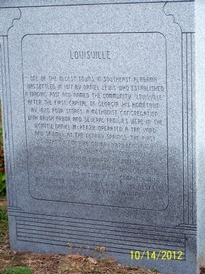
Louisville
Photographed by David J Gaines, October 14, 2012
1. Louisville Marker
Topics. This historical marker is listed in this topic list: Settlements & Settlers. A significant historical year for this entry is 1817.
Location. 31° 47.301′ N, 85° 33.16′ W. Marker is in Louisville, Alabama, in Barbour County. It is on Alabama Route 51, on the right when traveling south. Touch for map. Marker is in this post office area: Louisville AL 36048, United States of America. Touch for directions.

Regionally, this marker
this page online
Other nearby markers. At least 8 other markers are within 5 miles of this marker, measured as the crow flies: The Opening of the Second Phase of the Second Creek War (here, next to this marker); The Battles of Hobdy's Bridge and Pea River (here, next to this marker); Louisville and "Old Alabama" (a few steps from this marker); The Old County Court House (within shouting distance of this marker); Fire Bell (approx. 0.4 miles away); Louisville World War II Memorial (approx. ¾ mile away); Barbour County’s “Little Scotland” / Pea River Presbyterian Church (approx. 4.6 miles away); Pea River Presbyterian Church Cemetery (approx. 4.6 miles away). Touch for a list and map of all markers in Louisville.
Regarding Louisville. The marker is part of the
Photographed by David J Gaines, October 14, 2012
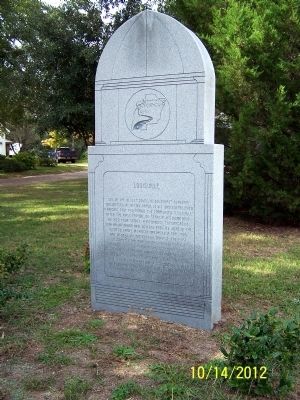
2. Louisville Marker
Credits. This page was last revised on June 16, 2016. It was originally submitted on November 1, 2012, by David J Gaines of Pinson, Alabama. This page has been viewed 1,578 times since then and 45 times this year. Photos: 1, 2. submitted on November 1, 2012, by David J Gaines of Pinson, Alabama. • Craig Swain was the editor who published this page.
