Fort Washington in Prince George's County, Maryland — The American Northeast (Mid-Atlantic)
Crossing the River
Let every man praise the bridge that carries him over. -- Anonymous
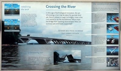
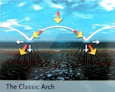
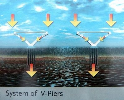
Redefining the arch
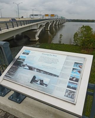
The design of the bridge, selected from among seven competing entries, reflects the arch tradition of other Potomac River crossings without actually using the classic arch. True Arches create large horizontal forces at the foundations -- a problem in the Potomac River where soils are particularly poor. An innovative system of V-shaped piers is used to transfer the load vertically through soft soil to firmer soils 200 feet below.
a balancing act
When tall ships approach, staff in the operator's House engage motors and machinery to open the drawbridge. The movable span -- called a bascule -- is a device that is counterbalanced so that it moves on a pivot, much like a seesaw. The bridge is so finely balanced that only small motors are needed to move the 34 million pounds of bridge, possibly the largest movable span in the world.
the construction process
This bridge, which replaced a deteriorating, undersized bridge in this location, uses high-performance materials, pre-fabricated components, and innovative construction techniques.
Up to six-foot diameter steel pipe piles were driven into the soil to support the foundations. A cofferdam, or watertight enclosure, provided a temporary dry area to build the concrete foundations.
Concrete pile caps and pier pedestals were formed on the top of the piles.
Prefabricated segments of the V-piers were transported to the site by barge and lifted into place by cranes.
The segments were placed, alternating left and right to keep the pier balanced.
The tips of the V-piers were connected and held together by slender concrete tie beams containing tensioned steel cables.
Curved steel girders completed the arch appearance and a concrete deck slab provided the final roadway surface.
Topics. This historical marker is listed in this topic list: Bridges & Viaducts.
Location. 38° 47.614′ N, 77° 1.501′ W. Marker is in Fort Washington, Maryland, in Prince George's County. Marker is on Interstate 95, on the left when traveling west. The marker is in a small park on the east (Maryland) end of the Woodrow Wilson Bridge. Touch for map. Marker is in this post office area: Oxon Hill MD 20745, United States of America. Touch for directions.
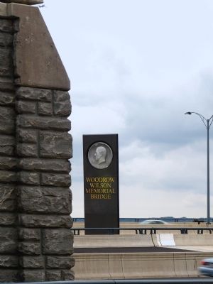
Other nearby markers. At least 8 other markers are within walking distance of this marker. Woodrow Wilson Memorial Bridge (a few steps from this marker); Two Worlds Meet in the Summer of 1608. (within shouting distance of this marker); Working to Improve the River (about 300 feet away, measured in a direct line); Potomac Fisheries (about 300 feet away); The Nation's River (about 300 feet away); Neighbor to the Nation's Capital (about 400 feet away); The Tobacco Economy (about 400 feet away); The Founding of Maryland (about 400 feet away). Touch for a list and map of all markers in Fort Washington.
Credits. This page was last revised on March 3, 2023. It was originally submitted on December 19, 2012, by Allen C. Browne of Silver Spring, Maryland. This page has been viewed 477 times since then and 10 times this year. Photos: 1, 2, 3, 4, 5, 6, 7. submitted on December 19, 2012, by Allen C. Browne of Silver Spring, Maryland. • Bill Pfingsten was the editor who published this page.
