Frankfort in Franklin County, Kentucky — The American South (East South Central)
Frankfort Chosen As Capital
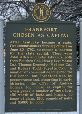
After Kentucky became a state, five commissioners were appointed on June 20, 1792, to choose a location for the state capital. They were John Allen and John Edwards (both from Bourbon Co.), Henry Lee (Mason Co.), Thomas Kennedy (Madison Co.), and Robert Todd (Fayette Co.). A number of communities competed for this honor, but Frankfort won by perseverance and, according to early histories, the offer of Andrew Holmes' log house as capitol for seven years, a number of town lots, £50 worth of locks and hinges, 10 boxes of glass, 1500 pounds of nails, and $3000 in gold.
(side 2)
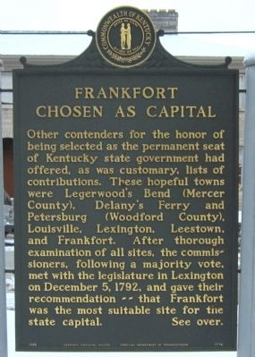
Other contenders for the honor of being selected as the permanent seat of Kentucky state government had offered, as was customary, lists of contributions. These hopeful towns were Legerwood's Bend (Mercer County), Delany's Ferry and Petersburg (Woodford County), Louisville, Lexington, Leestown, and Frankfort. After thorough examination of all sites, the commissioners, following a majority vote, met with the legislature in Lexington on December 5, 1792, and gave their recommendation -- that Frankfort was the most suitable site for the state capital. See over.
Erected 1985 by Kentucky Historical Society, Kentucky Department of Transportation. (Marker Number 1774.)
Topics and series. This historical marker is listed in these topic lists: Government & Politics • Settlements & Settlers. In addition, it is included in the Kentucky Historical Society series list. A significant historical month for this entry is June 1800.
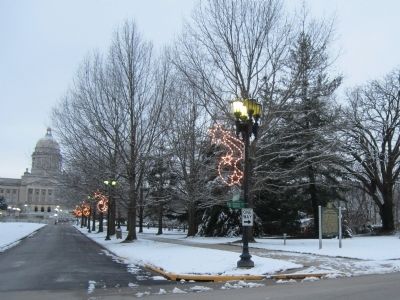
Location. 38° 11.373′ N, 84° 52.518′ W. Marker is in Frankfort, Kentucky, in Franklin County. Marker is at the intersection of Capital Avenue and West Todd Street, on the right when traveling south on Capital Avenue. Touch for map. Marker is in this post office area: Frankfort KY 40601, United States of America. Touch for directions.
Other nearby markers. At least 8 other markers are within walking distance of this marker. New Capitol (within shouting distance of this marker); Emma Guy Cromwell (about 500 feet away, measured in a direct line); The Frankfort Barracks (about 500 feet away); Frank Lloyd Wright / Rev. Jesse R. Zeigler House (about 500 feet away); Cherry Blossom Tree (about 500 feet away); Gold Star Families Memorial Monument (about 500 feet away); The Freedom Tree (about 700 feet away); Kentucky's Executive Mansion (approx. 0.2 miles away). Touch for a list and map of all markers in Frankfort.
Credits. This page was last revised on June 16, 2016. It was originally submitted on December 31, 2012, by Bernard Fisher of Richmond, Virginia. This page has been viewed 453 times since then and 28 times this year. Photos: 1, 2, 3. submitted on December 31, 2012, by Bernard Fisher of Richmond, Virginia.


