Verona in Lawrence County, Missouri — The American Midwest (Upper Plains)
Lawrence County
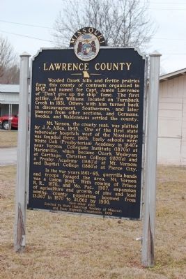
Wooded Ozark hills and fertile prairies for this county of contrasts organized in 1845 and named for Captain James Lawrence of “Don’t give up the ship” fame. The first settlers, John Williams, located on Turnback Creek in 1831. Others with him turned back in discouragement. Southerners and later pioneers from other sections and Germans and Swedes and Waldensians settled the county.
Mount Vernon, the county seat, was platted by J.A. Allen, 1845. One of the first state tubercular hospitals west of the Mississippi was founded there, 1905. Early schools were White Oak (Presbyterian) Academy in the 1840’s near Verona; Collegiate Institute (1870’s) at Marionville which later became Ozark Wesleyan at Carthage; Christian College (1870’s) and a Presby. Academy (1880’s) at Mount Vernon; and Baptist College (1880’s) at Pierce City.
In the war years, 1861-1865, guerrilla bands and troops foraged the area. Mount Vernon was a Union post. With the coming of Frisco R.R., 1870, and Mo Pac, 1907, expansion of agriculture and growth of zinc and mining, county population boomed from 13,067 in 1870 to 31,662 by 1910.
Marker Reverse
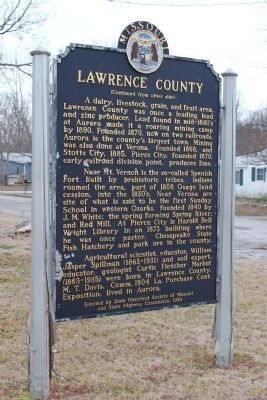
A dairy, livestock, grain and fruit area, Lawrence County was once a leading lead and zinc producer. Lead found in the mid 1880’s at Aurora made it a roaring mining camp by 1890. Founded 1870, now on two railroads, Aurora is the county’s largest town. Mining was also done in Verona, founded 1868, and Stotts City, 1885, Pierce City, founded 1870, and early railroad division point, produces lime.
Near Mount Vernon is the so called Spanish Fort built by prehistoric tribes. Indians roamed the area , part of the Osage land cession, into the 1830’s. Near Verona are site of what it said to be the first Sunday School in the western Ozarks, founded 1840 by J.M. White; the spring forming Spring River and Red Mill. At Pierce City is Harold Bell Wright Library in an 1873 building where he was once pastor. Chesapeake State Fish Hatchery and park are in the county.
Agricultural scientist, educator, William Jasper Spillman (1863-1931) and soil expert, educator, geologist, Curtis Fletcher Marbut (1863-1935) were born in Lawrence County. M.T. Davis, Comm. 1904 La. Purchase Cent. Exposition, lived in Aurora.
Erected 1959 by State Historical Society and State Highway Commission.
Topics and series. This historical marker is listed in this topic list: Settlements & Settlers. In addition, it is included in the Missouri, The State Historical Society of series list. A significant historical year for this entry is 1845.
Location. 36° 57.566′ N, 93° 47.786′ W. Marker is in Verona, Missouri, in Lawrence County. Marker is on 3rd Street near Main Street. Touch for map. Marker is in this post office area: Verona MO 65769, United States of America. Touch for directions.
Other nearby markers. At least 8 other markers are within 8 miles of this marker, measured as the crow flies. World War I Memorial (within shouting distance of this marker); Veterans Memorial (approx. 4.2 miles away); a different marker also named Veterans Memorial (approx. 4.3 miles away); Civil War Marker (approx. 4.4 miles away); Butterfield Overland Mail in Missouri — 1858-1861 (approx. 7˝ miles away); War Memorial (approx. 7.9 miles away); Christopher G. Stark Memorial (approx. 8 miles away); a different marker also named Veterans Memorial (approx. 8 miles away).
Credits. This page was last revised on June 16, 2016. It was originally submitted on January 26, 2013, by Mary Thurman of Wheelerville,, Missouri. This page has been viewed 901 times since then and 81 times this year. Photos: 1, 2. submitted on January 26, 2013, by Mary Thurman of Wheelerville,, Missouri. • Kevin W. was the editor who published this page.

