Jefferson in Schoharie County, New York — The American Northeast (Mid-Atlantic)
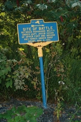
Site of Battle
Between Schoharie militia
under Capt. Jacob Hagar
of Upper Fort and Indians
and Tories under Chief
Brant, Nov. 2, 1781.
Topics. This historical marker is listed in these topic lists: Patriots & Patriotism • War, US Revolutionary. A significant historical date for this entry is October 2, 2003.
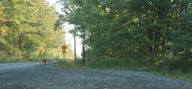
Location. 42° 26.216′ N, 74° 35.499′ W. Marker is in Jefferson, New York, in Schoharie County. Marker is on New York State Route 10, on the right when traveling north. The marker is at a Route 10 roadside pull-off just north of Deer Run Village. Touch for map. Marker is in this post office area: Jefferson NY 12093, United States of America. Touch for directions.
Other nearby markers. At least 8 other markers are within 4 miles of this marker, measured as the crow flies. Sugar Bush Raid (approx. 1.7 miles away); Mount Utsayantha (approx. 2.2 miles away); Herring Park (approx. 2.3 miles away); In Memory of Our Heroic Dead (approx. 2.4 miles away); Parker 13-Sided Barn (approx. 3.1 miles away); Mill Stones (approx. 3.2 miles away); Jefferson Academy (approx. 3.2 miles away); Masonic Lodge 554 (approx. 3.2 miles away). Touch for a list and map of all markers in Jefferson.
Additional keywords. Deer Run Village
Credits. This page was last revised on June 16, 2016. It was originally submitted on January 27, 2013, by Howard C. Ohlhous of Duanesburg, New York. This page has been viewed 713 times since then and 21 times this year. Photos: 1, 2, 3. submitted on January 27, 2013, by Howard C. Ohlhous of Duanesburg, New York. • Bill Pfingsten was the editor who published this page.


