Burns in Harney County, Oregon — The American West (Northwest)
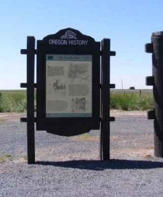
The Terrible Trail
Oregon History
In 1853, Elijah Elliott, a Willamette Valley settler, convinced over 1,000 people to attempt a shortcut over the Cascade Range. Following Meek’s route to Harney Valley, Elliott’s party diverged around the south shores of Harney and Malheur Lakes. Continuing westward, the party became disoriented. As the emigrants became increasingly desperate, scouts searched ahead for water and a route over the mountains. Eventually, scouts located a crude road over the Willamette Pass. One year later, William Macy led 121 wagons along a similar route without serious difficulty.
In 1845, frontiersman Stephen Meek persuaded over 1,000 people to leave the trail at present-day Vale and trek across the desert toward the upper Willamette Valley. Blazing a wagon road up the Malheur River they entered Harney Valley, near this site. Hunger, thirst, illness, and death stalked the wagon train as it wandered west and ultimately north toward the Columbia River. Bitterness against Meek became so intense that he was compelled to travel beyond rifle range. Meek eventually forged ahead to The Dalles, where a rescue party was organized, but relief arrived too late for more than twenty emigrants who were buried in lonely graves along the way.
Erected by State of Oregon.
Topics and series. This historical marker is listed in this topic list: Settlements & Settlers. In addition, it is included in the Oregon Beaver Boards series list. A significant historical year for this entry is 1853.
Location. 43° 36.804′ N, 118° 49.308′ W. Marker is in Burns, Oregon, in Harney County. Marker is at the intersection of U.S. 20 and South Harney Road, on the right when traveling east on U.S. 20. Touch for map. Marker is in this post office area: Burns OR 97720, United States of America. Touch for directions.
Other nearby markers. At least 1 other marker is within walking distance of this marker. Fort Harney (here, next to this marker).
Also see . . . Oregon Travel Experience - Peter Skene OgdenThe Terrible Trail. (Submitted on January 12, 2018, by Douglass Halvorsen of Klamath Falls, Oregon.)
Credits. This page was last revised on January 26, 2018. It was originally submitted on February 5, 2013, by Don Morfe of Baltimore, Maryland. This page has been viewed 786 times since then and 28 times this year. Photo 1. submitted on February 5, 2013, by Don Morfe of Baltimore, Maryland. • Syd Whittle was the editor who published this page.
Editor’s want-list for this marker. Clear readable close-up of the marker. • Can you help?
