Oskaloosa in Jefferson County, Kansas — The American Midwest (Upper Plains)
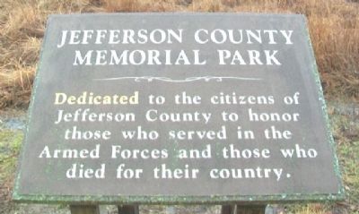
Jefferson County Memorial Park
Topics. This memorial is listed in this topic list: Military.
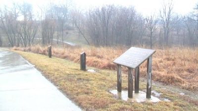
Location. 39° 12.344′ N, 95° 18.753′ W. Marker is in Oskaloosa, Kansas, in Jefferson County. Marker is along the walking path in Jefferson County Memorial Park, off Walnut Street (US Hwy 59) south of town. Touch for map. Marker is at or near this postal address: 1360 Walnut Street, Oskaloosa KS 66066, United States of America. Touch for directions.
Other nearby markers. At least 8 other markers are within walking distance of this marker. Bandstand (approx. half a mile away); Bowstring Bridge (approx. half a mile away); Edmonds Chapel (approx. half a mile away); Plum Grove School Buiding - Dist. No. 39 (approx. half a mile away); Kilgour School Building - Dist. No. 72 (approx. half a mile away); Tibbott School Building - Dist. No. 54 (approx. half a mile away); Ozawkie Mill Grinding Wheel (approx. 0.6 miles away); Reynolds Store (approx. 0.6 miles away). Touch for a list and map of all markers in Oskaloosa.
Credits. This page was last revised on September 3, 2020. It was originally submitted on March 12, 2013, by William Fischer, Jr. of Scranton, Pennsylvania. This page has been viewed 357 times since then and 17 times this year. Photos: 1, 2. submitted on March 12, 2013, by William Fischer, Jr. of Scranton, Pennsylvania.

