Gonzales in Monterey County, California — The American West (Pacific Coastal)
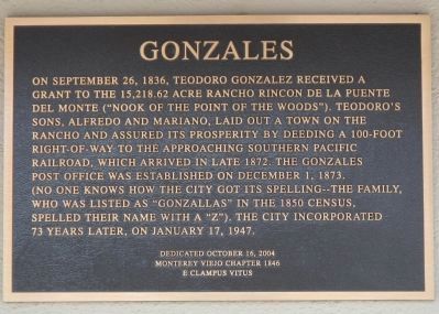
Gonzales
Erected 2004 by E Clampus Vitus, Monterey Viejo Chapter No. 1846.
Topics and series. This historical marker is listed in this topic list: Settlements & Settlers. In addition, it is included in the E Clampus Vitus series list. A significant historical month for this entry is January 1998.
Location. 36° 30.489′ N, 121° 26.588′ W. Marker is in Gonzales, California, in Monterey County. Marker is on 4th Street near Center Street, on the left when traveling east. Touch for map. Marker is at or near this postal address: 145 4th Street, Gonzales CA 93926, United States of America. Touch for directions.
Other nearby markers. At least 8 other markers are within 9 miles of this marker, measured as the crow flies. The Mustard Seed Trail (about 500 feet away, measured in a direct line); Gonzales Veterans Memorial (about 500 feet away); The Stag Saloon (about 700 feet away); Railroad Station Site (approx. 8½ miles away); Cesar Chavez Park (approx. 8½ miles away); Mission Nuestra Señora Dolorosísima de la Soledad (approx. 8.6 miles away); The De Anza Expedition in Soledad (approx. 8.6 miles away); El Camino Real Bell (approx. 8.6 miles away). Touch for a list and map of all markers in Gonzales.
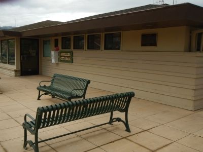
More about this marker. This marker is located on the Gonzales City Hall Building.
Also see . . . Gonzales, California - Monterey County Historical Society. (Gonzales) was founded by Dr. Mariano Gonzalez and his brother Alfredo Gonzalez in 1874. (Submitted on April 8, 2013, by Barry Swackhamer of Brentwood, California.)
Credits. This page was last revised on June 16, 2016. It was originally submitted on April 8, 2013, by Barry Swackhamer of Brentwood, California. This page has been viewed 577 times since then and 18 times this year. Photos: 1, 2. submitted on April 8, 2013, by Barry Swackhamer of Brentwood, California. • Syd Whittle was the editor who published this page.

