Hamilton Township in Atlantic County, New Jersey — The American Northeast (Mid-Atlantic)
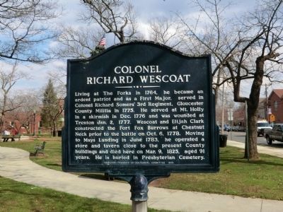
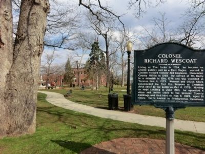
Colonel Richard Wescoat
Erected 1975 by Hamilton Township Bi-Centennial Committee.
Topics. This historical marker is listed in this topic list: War, US Revolutionary. A significant historical month for this entry is June 1783.
Location. 39° 27.132′ N, 74° 43.65′ W. Marker is near Hamilton, New Jersey, in Atlantic County. It is in Hamilton Township. Marker is at the intersection of Main Street and Harding Highway on Main Street. Touch for map. Marker is at or near this postal address: 1841 Main St, Mays Landing NJ 08330, United States of America. Touch for directions.
Other nearby markers. At least 8 other markers are within walking distance of this marker. The Presbyterian Church, Mays Landing (within shouting distance of this marker); Veterans Memorial (within shouting distance of this marker); Fallen Soldiers Memorial (within shouting distance of this marker); World War I Memorial (within shouting distance of this marker); 9-11-2001 (within shouting distance of this marker); Atlantic County Court House (about 400 feet away, measured in a direct line); American Hotel (about 700 feet away); POW★MIA (approx. 0.2 miles away). Touch for a list and map of all markers in Hamilton.
Credits. This page was last revised on February 7, 2023. It was originally submitted on April 9, 2013, by Don Morfe of Baltimore, Maryland. This page has been viewed 801 times since then and 42 times this year. Photos: 1, 2. submitted on April 9, 2013, by Don Morfe of Baltimore, Maryland. • Bill Pfingsten was the editor who published this page.

