Near Dunkirk in Chautauqua County, New York — The American Northeast (Mid-Atlantic)
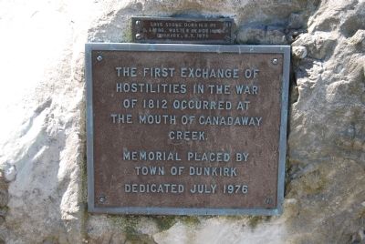
The First Exchange of Hostilities
Erected 1976 by Town of Dunkirk.
Topics. This historical marker is listed in this topic list: War of 1812. A significant historical year for this entry is 1812.
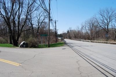
Location. 42° 28.553′ N, 79° 21.89′ W. Marker is near Dunkirk, New York, in Chautauqua County. Marker is at the intersection of West Lake Road (New York State Route 5) and Temple Road, on the left when traveling west on West Lake Road. Located on a rock near the site. Touch for map. Marker is in this post office area: Dunkirk NY 14048, United States of America. Touch for directions.
Other nearby markers. At least 8 other markers are within 2 miles of this marker, measured as the crow flies. Dedicated to Corporal Cyrus W. James (approx. 1.3 miles away); "Ong-Gwe-Ohn-Weh" (approx. 1.3 miles away); Sarah Sinfield (approx. 1.3 miles away); Large Anchor (approx. 1.3 miles away); The Lighthouse Service (approx. 1.4 miles away); Dunkirk Lighthouse (approx. 1.4 miles away); On September 26, 1812 (approx. 1.4 miles away); B.P.O. Elks (approx. 1˝ miles away). Touch for a list and map of all markers in Dunkirk.
Credits. This page was last revised on June 16, 2016. It was originally submitted on April 22, 2013, by Mike Wintermantel of Pittsburgh, Pennsylvania. This page has been viewed 752 times since then and 62 times this year. Photos: 1, 2. submitted on April 22, 2013, by Mike Wintermantel of Pittsburgh, Pennsylvania.

