Near Columbia in Tuolumne County, California — The American West (Pacific Coastal)
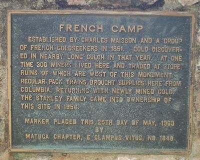
French Camp
Erected 1963 by E Clampus Vitus, Matuca Chapter No. 1849.
Topics and series. This historical marker is listed in this topic list: Settlements & Settlers. In addition, it is included in the E Clampus Vitus series list. A significant historical year for this entry is 1851.
Location. 38° 4.695′ N, 120° 21.817′ W. Marker is near Columbia, California, in Tuolumne County. Marker can be reached from Forest Service Road 3N15. Touch for map. Marker is in this post office area: Columbia CA 95310, United States of America. Touch for directions.
Other nearby markers. At least 8 other markers are within 4 miles of this marker, measured as the crow flies. Welcome to Italian Bar (approx. 1.6 miles away); Monitor of Knickerbocker Flat (approx. 1.7 miles away); Columbia Marble Quarry (approx. 3.3 miles away); Columbia Cemetery (approx. 3.3 miles away); Columbia School House (approx. 3.3 miles away); Columbia Masonic Cemetery (approx. 3.3 miles away); To Honor the Chinese Pioneers (approx. 3.3 miles away); Charles Crist Kress (approx. 3.3 miles away). Touch for a list and map of all markers in Columbia.
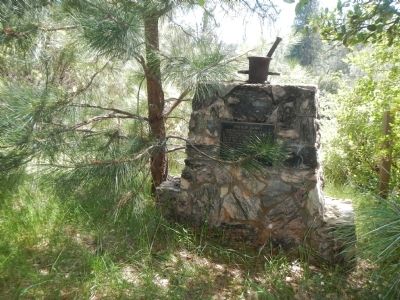
More about this marker. This marker is on private property located inside Stanislaus National Forest. This property is approximately 3 1/2 miles, as the crow flies, northeast of Columbia State Park. The nearest public road is Forest Service Road 3N15.
Thanks to Russell Peak and Brian Bradford for providing access to this marker.
Credits. This page was last revised on June 16, 2016. It was originally submitted on April 29, 2013, by Barry Swackhamer of Brentwood, California. This page has been viewed 654 times since then and 70 times this year. Photos: 1, 2, 3. submitted on April 29, 2013, by Barry Swackhamer of Brentwood, California. • Syd Whittle was the editor who published this page.


