Acre, Haifa District, Israel — West Asia (the Levant in the Middle East)
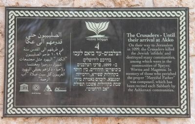
The Crusaders
Until their arrival at Akko
Photographed by Dale K. Benington, March 8, 2013
1. The Crusaders Marker
Topics. This historical marker is listed in these topic lists: Disasters • Settlements & Settlers.
Location. 32° 55.416′ N, 35° 4.228′ E. Marker is in Acre, Haifa District. It can be reached from Weizman Street just west of Omar El Mukhtar, on the right when traveling south. This historical marker is located within the fortified walls of the Old City of Acre. Upon passing through the main gates of the Old City, turn immediately to your right, where tourist parking and the visitor's center are located. Once you have gone through the visitor center, you will step out into a good sized open courtyard. The historical marker is affixed to a wall of a small structure in the southeast corner of the courtyard. Touch for map. Marker is in this post office area:
this page online

Regionally, it is in Asia, specifically in West Asia, in the Middle East, in The Levant, on the Red Sea, in a coastal Mediterranean country, and in the Western World. Historically, it finds itself in what was once the Byzantine Empire, the Ottoman Empire, a British Mandate, and the Roman Empire.
Other nearby markers. At least 7 other markers are within 18 kilometers of this marker, measured as the crow flies: The Crusader Fortress of the Knights of the Hospital and the Ottoman-Turkish Citadel of Akko (within shouting distance of this marker); The Shrine and Mansion of Bahá’u’lláh (approx. 3.4 kilometers away); Exodus (approx. 13 kilometers away); The German Colony Story (approx. 14 kilometers away); Raoul Wallenberg's Residence (approx. 14.7 kilometers away); The Shrine of the Báb Terraces and Gardens (approx. 14.8 kilometers away); The Lion's Trail - Nesher (approx. 17.6 kilometers away).
More about this marker. I confess that my initial GPS readings proved to be inaccurate and when I began posting this marker those original GPS co-ordinates showed the marker
Photographed by Dale K. Benington, March 8, 2013
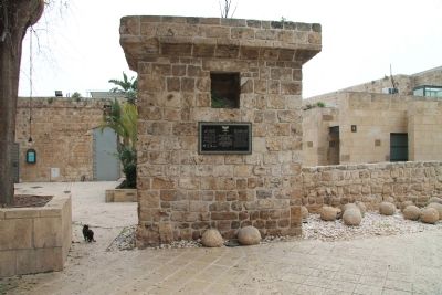
2. The Crusaders Marker
View of historical marker affixed to the north side of a small, cut stone structure. Note catapult stones at base of structure.
Also see . . .
1. Akko. This is a link to information provided by the Old Acre Development Company. (Submitted on May 20, 2013, by Dale K. Benington of Toledo, Ohio.)
2. Acre, Israel. This is a link to information provided by Wikipedia, the free encyclopedia. (Submitted on May 20, 2013, by Dale K. Benington of Toledo, Ohio.)
Photographed by Dale K. Benington, March 8, 2013
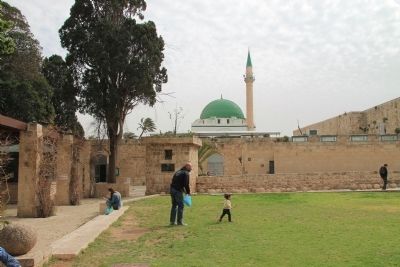
3. The Crusaders Marker
View of the historical marker, affixed to a small cut stone structure, on the southeast corner of the courtyard. Note the Al Jazzar Mosque in the background of the picture.
Photographed by Dale K. Benington, March 8, 2013
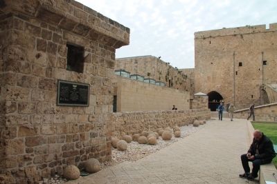
4. The Crusaders Marker
View of the historical marker, looking west, toward the fortress complex. Note catapult stones at base of structure and along the pathway leading to the fortress complex.
Credits. This page was last revised on June 16, 2016. It was originally submitted on May 20, 2013, by Dale K. Benington of Toledo, Ohio. This page has been viewed 774 times since then and 19 times this year. Photos: 1, 2, 3, 4. submitted on May 20, 2013, by Dale K. Benington of Toledo, Ohio.
