Verdi in Washoe County, Nevada — The American Mountains (Southwest)
Verdi
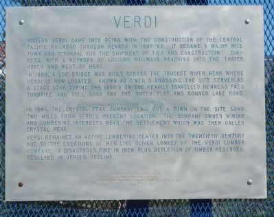
Photographed by Barry Swackhamer, June 3, 2013
1. Verdi Marker
In 1860, a log bridge was built across the Truckee River near where Verdi is now located. Known as O’Neils Crossing, the site served as a stage stop during the 1860’s on the heavily travelled Henness Pass Turnpike and Toll Road and the Dutch Flat and Donner Lake Road.
In 1864, the Crystal Peak Company laid out a town on the site some two miles from Verdi’s present location. The company owned mining and lumber interests near the settlement which was then called Crystal Peak.
Verdi remained an active lumbering center into the twentieth century due to the exertions of men like Oliver Lonkey of the Verdi Lumber Company. A disastrous fire in 1928 plus depletion of timber reserves resulted in Verdi’s decline.
Erected by Nevada State Park System & National Society Daughters of the American Colonists. (Marker Number 191.)
Topics and series.
this page online
Location. 39° 30.966′ N, 119° 59.612′ W. Marker is in Verdi, Nevada, in Washoe County. It is at the intersection of 3rd Street and Crystal Peak Park Road, on the left when traveling west on 3rd Street. Touch for map. Marker is in this post office area: Verdi NV 89439, United States of America. Touch for directions.

Regionally, this marker is in the Sierra Nevada, in the Lake Tahoe Basin, and in Greater Reno Area. It is also in the American Mountain West. Globally, it is in North America, the Western Hemisphere, the Western World, and the Anglosphere. Historically, it finds itself in what was once New Spain and also Mexico’s Alta California.
Other nearby markers. At least 8 other markers are within walking distance of this marker: Truckee Trail - Last Crossing (approx. 0.2 miles away); Inyo Marble Works (approx. ¼ mile away); a different marker also named The Great Train Robbery
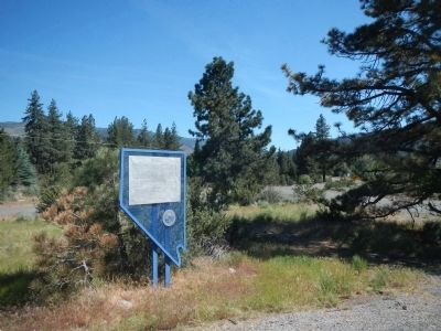
Photographed by Barry Swackhamer, June 3, 2013
2. Verdi Marker
Another marker is no longer nearby. The Great Train Robbery (was approx. 0.3 miles away but has been replaced with another marker now near it).
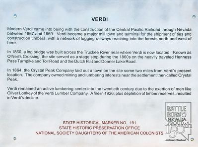
Photographed by Alvis Hendley, March 18, 2016
3. Verdi Marker
An updated marker replaced the older version. The wording did not change.
Credits. This page was last revised on June 16, 2016. It was originally submitted on June 16, 2013, by Barry Swackhamer of Brentwood, California. This page has been viewed 1,245 times since then and 69 times this year. Photos: 1, 2. submitted on June 16, 2013, by Barry Swackhamer of Brentwood, California. 3. submitted on April 28, 2016, by Alvis Hendley of San Francisco, California. • Syd Whittle was the editor who published this page.
