Elmwood in West Hartford in Hartford County, Connecticut — The American Northeast (New England)
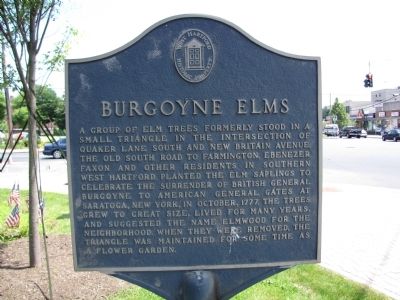
Burgoyne Elms
Erected by West Hartford History Property.
Topics. This memorial is listed in these topic lists: Settlements & Settlers • War, US Revolutionary. A significant historical month for this entry is October 1777.
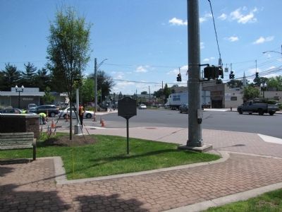
Location. 41° 43.966′ N, 72° 43.897′ W. Marker is in West Hartford, Connecticut, in Hartford County. It is in Elmwood. Memorial is at the intersection of Quaker Lane South and New Britain Avenue (Connecticut Route 173), on the right when traveling south on Quaker Lane South. Touch for map. Marker is at or near this postal address: 1121 New Britain Ave, West Hartford CT 06110, United States of America. Touch for directions.
Other nearby markers. At least 8 other markers are within 2 miles of this marker, measured as the crow flies. Burgoyne Rest (here, next to this marker); Berry-Rosenblatt US Army Reserve Center (approx. half a mile away); Noah Webster Birthplace (approx. 1.2 miles away); Korczak Ziolkowski (approx. 2 miles away); Webster Walk (approx. 2 miles away); a different marker also named Webster Walk (approx. 2 miles away); Goodman Green (approx. 2.1 miles away); Hartford Vietnam War Memorial (approx. 2.1 miles away). Touch for a list and map of all markers in West Hartford.
Credits. This page was last revised on June 28, 2023. It was originally submitted on June 26, 2013, by Lee Hattabaugh of Capshaw, Alabama. This page has been viewed 668 times since then and 47 times this year. Photos: 1, 2. submitted on June 26, 2013, by Lee Hattabaugh of Capshaw, Alabama. • Bill Pfingsten was the editor who published this page.

