Maryville in Nodaway County, Missouri — The American Midwest (Upper Plains)
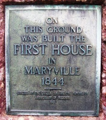
First House in Maryville
was built the
First House
in Maryville
1844
Erected by the Citizens
on the one hundredth
anniversary of Missouri
Erected 1921 by the Citizens of Maryville.
Topics. This historical marker is listed in this topic list: Settlements & Settlers. A significant historical year for this entry is 1844.
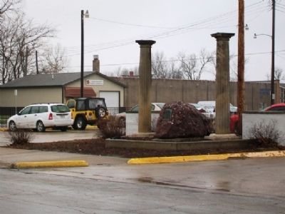
Location. 40° 20.826′ N, 94° 52.428′ W. Marker is in Maryville, Missouri, in Nodaway County. Marker is on 2nd Street east of Buchanan Street, on the right when traveling west. Touch for map. Marker is in this post office area: Maryville MO 64468, United States of America. Touch for directions.
Other nearby markers. At least 8 other markers are within walking distance of this marker. Maryville (about 500 feet away, measured in a direct line); Nodaway County Courthouse (about 600 feet away); Nodaway County Veterans Memorial (about 600 feet away); Lanning's Mill Stone (about 600 feet away); Maryville Freedom Rock Veterans Memorial (approx. 0.4 miles away); Sisters of St. Francis (approx. 0.6 miles away); Welton Ideker (approx. 0.6 miles away); Northwest Missouri State University Administration Building (approx. 0.7 miles away). Touch for a list and map of all markers in Maryville.
Also see . . .
1. City of Maryville, Missouri, Official Website. (Submitted on July 6, 2013, by William Fischer, Jr. of Scranton, Pennsylvania.)
2. The Nodaway County Historical Society. (Submitted on July 6, 2013, by William Fischer, Jr. of Scranton, Pennsylvania.)
Credits. This page was last revised on December 19, 2020. It was originally submitted on July 6, 2013, by William Fischer, Jr. of Scranton, Pennsylvania. This page has been viewed 480 times since then and 31 times this year. Photos: 1, 2, 3. submitted on July 6, 2013, by William Fischer, Jr. of Scranton, Pennsylvania.


