Pryor in Mayes County, Oklahoma — The American South (West South Central)
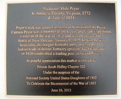
Nathaniel Hale Pryor
b. Amherst County, Virginia, 1772
— d. June of 1831 —
Pryor Creek was named in honor of Nathaniel Hale Pryor. Captain Pryor was a member of the Lewis and Clark Expedition, a veteran of the war of 1812 and was a Captain at the Battle of New Orleans, January 8, 1815. In June he was honorably discharged from the army and returned to Indian trade in Indian Territory (present day Oklahoma) in 1820 established a trading post on Grand River.
In grateful appreciation this marker is erected by Private Jacob Holley Chapter 322 under the auspices of the National Society United States Daughters of 1812 to celebrate the Bicentennial of the War of 1812
June 26, 2012
Erected 2012 by Private Jacob Holley Chapter 322, NSUSD of 1812.
Topics and series. This historical marker is listed in these topic lists: Industry & Commerce • Patriots & Patriotism • Settlements & Settlers • War of 1812. In addition, it is included in the Lewis & Clark Expedition, and the United States Daughters of 1812, National Society series lists. A significant historical date for this entry is January 8, 1815.
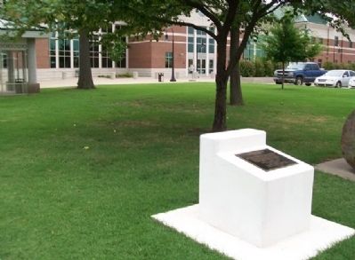
Location. 36° 18.565′ N, 95° 18.961′ W. Marker is in Pryor, Oklahoma, in Mayes County. Marker is at the intersection of Adair Street and NE 1st Street, on the right when traveling north on Adair Street . Marker is on the northwest grounds of the county courthouse. Touch for map. Marker is at or near this postal address: 1 Court Place, Pryor OK 74361, United States of America. Touch for directions.
Other nearby markers. At least 8 other markers are within 17 miles of this marker, measured as the crow flies. Veterans Memorial (here, next to this marker); Chouteau's Post (approx. 9.4 miles away); Battle of Locust Grove (approx. 12 miles away); Union Mission and Cemetery (approx. 12.9 miles away); Union Mission (approx. 12.9 miles away); Cabin Creek Battlefield (approx. 13.3 miles away); 1928 Route 66 Footrace (approx. 14.3 miles away); Cabin Creek (approx. 16.4 miles away).
Also see . . . Nathaniel Hale Pryor: A man of character and ability. Discover Lewis and Clark website entry (Submitted on August 25, 2013, by William Fischer, Jr. of Scranton, Pennsylvania.)
Credits. This page was last revised on April 15, 2022. It was originally submitted on August 25, 2013, by William Fischer, Jr. of Scranton, Pennsylvania. This page has been viewed 958 times since then and 36 times this year. Photos: 1, 2. submitted on August 25, 2013, by William Fischer, Jr. of Scranton, Pennsylvania.

