Near New Castle in New Castle County, Delaware — The American Northeast (Mid-Atlantic)
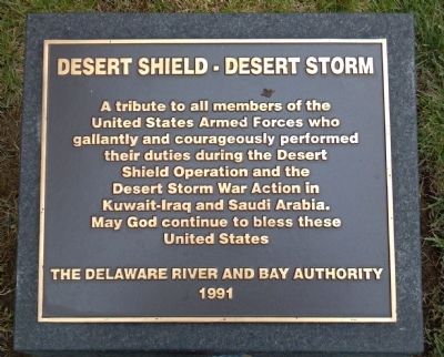
Delaware - Desert Shield / Desert Storm Memorial
— by the Delaware River and Bay Authority —
A tribute to all members of the United States Armed Forces who gallantly and courageously performed their duties during the Desert Shield Operation and the
Desert Storm War Action in Kuwait-Iraq and Saudi Arabia. May God continue to
bless these United States
Erected 1991 by The Delaware River and Bay Authority.
Topics. This memorial is listed in these topic lists: Military • War, 1st Iraq & Desert Storm.
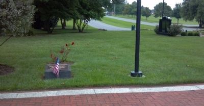
Location. 39° 41.685′ N, 75° 33.028′ W. Marker is near New Castle, Delaware, in New Castle County. Memorial can be reached from the intersection of Cherry Lane and New Castle Avenue (Delaware Route 9). Touch for map. Marker is in this post office area: New Castle DE 19720, United States of America. Touch for directions.
Other nearby markers. At least 8 other markers are within walking distance of this marker. Delaware Memorial Bridge (a few steps from this marker); Delaware & New Jersey WWII Submariners Memorial (a few steps from this marker); Delaware River and Bay Authority Vietnam Memorial (a few steps from this marker); Wounded Combat Veterans Memorial (within shouting distance of this marker); Korean War Veterans Memorial (within shouting distance of this marker); Delaware River and Bay Authority Veterans Dedication (within shouting distance of this marker); The Collins Park Bombings (approx. ¼ mile away); Crane Hook Church (approx. ¾ mile away). Touch for a list and map of all markers in New Castle.
Credits. This page was last revised on March 5, 2020. It was originally submitted on August 31, 2013, by Keith S Smith of West Chester, Pennsylvania. This page has been viewed 610 times since then and 29 times this year. Last updated on March 3, 2020, by Carl Gordon Moore Jr. of North East, Maryland. Photos: 1, 2. submitted on August 31, 2013, by Keith S Smith of West Chester, Pennsylvania. • Bill Pfingsten was the editor who published this page.

