
Springfield in Union County, New Jersey — The American Northeast (Mid-Atlantic)
The Jersey Militia and Continental Army
Photographed by Bill Coughlin, April 5, 2008
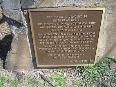
1. NJ Soldier Monument Marker
those brave men of
the New Jersey Militia and Continental Army
who fought the Battle of Springfield
June 7 to June 23, 1780.
The battle took place between the bridge crossing
near Morris Avenue and the east
branch of the Rahway River and west to
the second bridge at Van Winkles Brook.
The British defeat here ended their
stronghold in New Jersey and removed all
threat to the Continental Army.
Presented by Springfield VFW
Battle Hill Post 7683
Donated by UCTU 1991
Erected 1991 by Springfield VFW Battle Hill Post 7683.
Topics. This historical marker is listed in this topic list: War, US Revolutionary. A significant historical month for this entry is June 1905.
Location. 40° 42.458′ N, 74° 18.139′ W. Marker is in Springfield, New Jersey, in Union County. It is at the intersection of Washington Avenue and Angel Avenue, on the left when traveling south on Washington Avenue. Touch for map. Marker is in this post office area: Springfield NJ 07081, United States of America. Touch for directions.

Regionally, this marker is in New Jersey’s North Jersey, in Greater Newark, and in the New York City Metropolitan
this page online
Other nearby markers. At least 8 other markers are within walking distance of this marker: To the memory of Colonel Israel Angell (within shouting distance of this marker); Colonel Elias Dayton (within shouting distance of this marker); The Cannonball House (approx. 0.3 miles away); Battle of Springfield (approx. 0.3 miles away); Colonial Church (approx. half a mile away); Springfield (approx. half a mile away); a different marker also named The Battle of Springfield (approx. half a mile away); Patriots who fell at Springfield (approx. half a mile away). Touch for a list and map of all markers in Springfield.
Also see . . . The Battles of Connecticut Farms and Springfield. (Submitted on April 5, 2008, by Bill Coughlin of Woodland Park, New Jersey.)
Photographed by Bill Coughlin, April 5, 2008
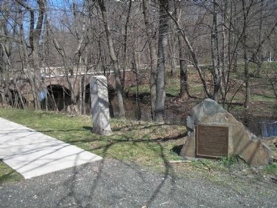
2. Markers for the Battle of Springfield
These markers are on the bank of the Rahway River, where the Americans under Gen. Greene first encountered the advancing British.
Photographed by Bill Coughlin, April 5, 2008
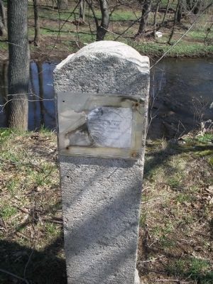
3. Old Battle of Springfield Marker
This old marker for the Battle of Springfield included a paper with text under plexiglass on a post. The plexiglass has long since broken, and the text is no longer legible. The other plaque was meant as a replacement for this one.
Credits. This page was last revised on June 16, 2016. It was originally submitted on April 5, 2008, by Bill Coughlin of Woodland Park, New Jersey. This page has been viewed 2,078 times since then and 37 times this year. Photos: 1, 2, 3. submitted on April 5, 2008, by Bill Coughlin of Woodland Park, New Jersey. • Craig Swain was the editor who published this page.
