Quindaro Bluffs in Kansas City in Wyandotte County, Kansas — The American Midwest (Upper Plains)
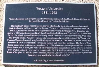
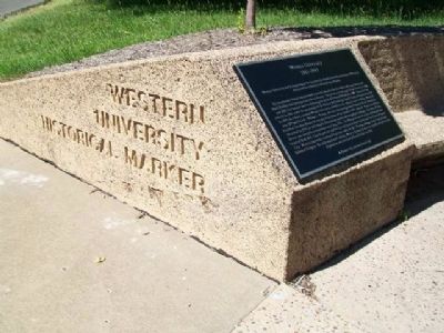
Western University
1881 - 1943
— A Kansas City, Kansas Historic Site —
Western University had its beginning in the Quindaro Freedman's School founded in the 1860s by the Reverend Eben Blachley, a Presbyterian Minister.
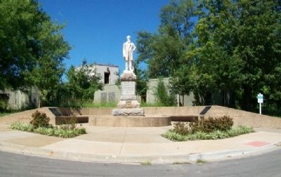
The Freedmen's School was intended to provide education for the children of escaped slaves and black families that had begun to settle in the area. The school received support from the state in 1867 and 1873, but became inactive following the death of Reverend Blachley in 1877. The school was revived in 1881 under the sponsorship of the African Methodist Episcopal Church and reopened in 1882. In 1891 the school, renamed Western University moved from the valley to a new building, Ward Hall, near 27th and Sewell. William T. Vernon, who was subsequently named Registrar of the Treasury by President Theodore Roosevelt was placed in charge of the school in 1896, when Dr. Vernon retired from the school in 1910, he left behind a flourishing campus with many fine buildings. The statue of John Brown was unveiled on Commencement Day, 1911. The Monument was the project of Bishop Abram Grant of the A.M.E. Church, and was paid for by contributions from students and the citizens of Kansas City. Western University continued to prosper under Dr. H.T. Kealing, adding a Junior College and a School of Religion. As with many small schools, Western University was severely affected by the Great Depression, and was finally forced to close in 1943.
Topics and series. This historical marker is listed in these topic lists: African Americans • Churches & Religion • Education. In addition, it is included in the African Methodist Episcopal (AME) Church, the Former U.S. Presidents: #26 Theodore Roosevelt, and the Historically Black Colleges and Universities series lists. A significant historical year for this entry is 1867.
Location. 39° 8.941′ N, 94° 39.558′ W. Marker is in Kansas City, Kansas, in Wyandotte County. It is in Quindaro Bluffs. Marker is at the intersection of 27th Street and Sewell Avenue, on the left when traveling north on 27th Street. Touch for map. Marker is in this post office area: Kansas City KS 66104, United States of America. Touch for directions.
Other nearby markers. At least 8 other markers are within 3 miles of this marker, measured as the crow flies. John Brown (here, next to this marker); Quindaro, Kansas (a few steps from this marker); Quindaro Ruins Archaeological Park (approx. 0.2 miles away); Mather Hall - Kansas City University (approx. 1˝ miles away); Eliza Burton Conley (approx. 3 miles away); Helena Conley (approx. 3 miles away); Silas Armstrong (approx. 3 miles away); The History of the Wyandot Indian Nation (approx. 3 miles away). Touch for a list and map of all markers in Kansas City.
Also see . . .
1. Western University at Kansapedia. (Submitted on October 17, 2013, by William Fischer, Jr. of Scranton, Pennsylvania.)
2. Quindaro and Western University Ruins. (Submitted on October 17, 2013, by William Fischer, Jr. of Scranton, Pennsylvania.)
3. Western University at Wikipedia. (Submitted on October 17, 2013, by William Fischer, Jr. of Scranton, Pennsylvania.)
Credits. This page was last revised on February 10, 2023. It was originally submitted on October 17, 2013, by William Fischer, Jr. of Scranton, Pennsylvania. This page has been viewed 684 times since then and 38 times this year. Photos: 1, 2, 3. submitted on October 17, 2013, by William Fischer, Jr. of Scranton, Pennsylvania.


