Pinewood in Sumter County, South Carolina — The American South (South Atlantic)
Millford Plantation
Photographed by Mike Stroud, October 17, 2013
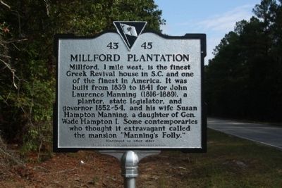
1. Millford Plantation Marker
(Front text)
Millford, 1mile west, is the finest Greek Revival house in S.C. and one of the finest in America. It was built from 1839 to 1841 for John Laurence Manning (1816-1889), a planter, state legislator, and governor 1852-54, and his wife Susan Hampton Manning, a daughter of Gen. Wade Hampton I. Some contemporaries who thought it extravagant called the mansion "Manning's Folly."
(Reverse text)
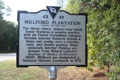
The three-story, stucco-over-brick house features a massive portico with six fluted Corinthian columns. Noted interior features include a dome and oculus over a circular stair, and double parlors. Many elaborate interior finishes are designs from Minard Lafever's Beauties of Modern Architecture (1835). Millford was designated a National Historic Landmark in 1973.
Erected 2012 by The Classical American Homes Preservation Trust. (Marker Number 43-45.)
Topics and series. This historical marker is listed in this topic list: Notable Buildings. In addition, it is included in the National Historic Landmarks series list. A significant historical year for this entry is 1839.
Location. 33° 44.883′ N, 80° 30.731′ W.
this page online

Regionally, this marker is in South Carolina’s Pee Dee. It is also in the American South and specifically in the Deep South. Globally, it is in North America, the Western Hemisphere, the Western World, and the Anglosphere. Historically, it finds itself in what was once the territory of the Mississippian Culture, one of the original Thirteen Colonies, one of the Confederate States of America, and the Antebellum South.
Other nearby markers. At least 8 other markers are within 8 miles of this marker, measured as the crow flies: Richard Richardson (within shouting distance of this marker); St. Mark's Episcopal Church (within shouting distance of this marker); Col. David Dubose Gaillard (approx. 1.4 miles away); Site of Manchester (approx. 6.3 miles away); Encounter at Halfway Swamp / Site of Original St. Mark's Church (approx. 6½ miles away);
Photographed by Mike Stroud, October 17, 2013
2. Millford Plantation Marker, reverse side
Another marker is no longer nearby. Encounter At Halfway Swamp / Site Of Original St. Mark's Church (was approx. 6½ miles away but has been replaced with another marker now near it).
Regarding Millford Plantation. National Register of Historic Places:
Millford Plantation (added 1971 - - #71000808)
♦ Historic Significance: Architecture/Engineering, Event
♦ Architect, builder, or engineer: Unknown
♦ Architectural Style: Greek Revival
♦ Area of Significance: Architecture, Politics/Government
♦ Period of Significance: 1825-1849
♦ Owner: Private
♦ Historic Function: Domestic
(Gov. John L. Manning House; Millford) Symbolic of the rural community life that flourished before the
Civil War, Milford, ca. 1839, is considered one of the most outstanding Greek Revival plantation homes in the South. Having escaped being burned by General W. T. Sherman’s troops, it remains a museum piece of the traditional
Photographed by Mike Stroud, October 17, 2013
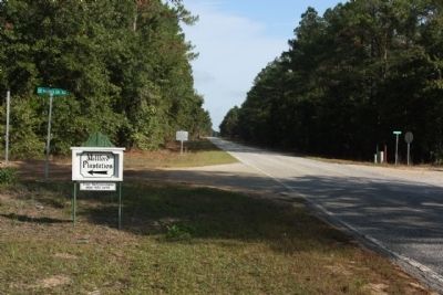
3. Millford Plantation Marker seen looking north on Camp Mac Boykin Road, at St Marks Church Road
While Potter may have designed the building as well, the architect is unknown. The property also includes contributing guesthouses/dependencies, a ca. 1850 stable and water tower (bell tower), and a spring house. Listed in the National
Photographed by Mike Stroud, October 17, 2013
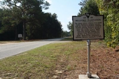
4. Millford Plantation Marker, looking south along Camp Mac Boykin Road (CR 51)
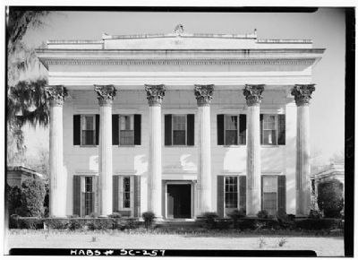
Photographed by Jack E. Boucher, circa 1960
5. Millford Plantation escaped being burned by General W. T. Sherman’s troops,
Library of Congress Prints and Photographs Division
HABS SC,43-PINWO.V,1--2
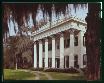
Photographed by Brian Cary, `
6. Millford Plantation
Library of Congress Prints and Photographs Division,
HABS SC,43-PINWO.V,1--22 (CT)
Credits. This page was last revised on June 16, 2016. It was originally submitted on October 20, 2013, by Mike Stroud of Bluffton, South Carolina. This page has been viewed 2,587 times since then and 90 times this year. Photos: 1, 2. submitted on October 21, 2013, by Mike Stroud of Bluffton, South Carolina. 3, 4, 5, 6. submitted on October 20, 2013, by Mike Stroud of Bluffton, South Carolina.
