Soulsbyville in Tuolumne County, California — The American West (Pacific Coastal)
Soulsbyville
Inscription.
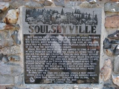
Ben Soulsby first settled here in 1851. His son, young Ben, when age 12, discovered the first gold in the area by accident. One evening, while walking the family cow home, he saw some gold, told his father who, upon investigation, found a rich vein of ore near the surface of the ground.
Young Ben was much excited and wanted to stake a claim at once. However since he was too young his father took it up for him. The mine was called the Soulsby Mine. People settled here making a large camp which was later called Soulsbyville. The mine, one of the first hardrock mines in Tuolumne Co., was worked exclusively by Cornish miners. Between 60 and 70 "Cousin Jacks" as they were known, were employed here. Veins of gold bearing ore ran 12" wide to a depth of 650' requiring the operation of 2 Ingersoll and 2 Darlington drills along with a 15 stamp mill.
By May, 1877 the town had 2 general stores, a meat market, school, church, 3 booming saloons and several boarding houses.
Erected 1986 by E Clampus Vitus, Matuca Chapter No. 1849.
Topics and series. This historical marker is listed in these topic lists: Industry & Commerce • Settlements & Settlers. In addition, it is included in the E Clampus Vitus series list. A significant historical month for this entry is May 1877.
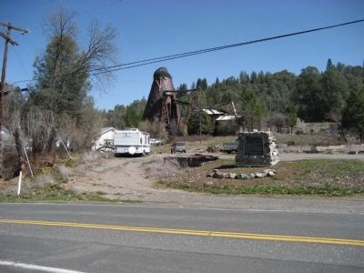
Location. 37° 59.098′ N, 120° 15.824′ W. Marker is in Soulsbyville, California, in Tuolumne County. Marker is on Soulsbyville Road, 0.9 miles south of Sonora Pass Highway (State Highway 108), on the left when traveling south. Original Soulsbyville marker is across the street. Touch for map. Marker is in this post office area: Soulsbyville CA 95372, United States of America. Touch for directions.
Other nearby markers. At least 8 other markers are within 3 miles of this marker, measured as the crow flies. A different marker also named Soulsbyville (within shouting distance of this marker); Cherokee (approx. 0.9 miles away); Ralph’s Station (approx. 1.4 miles away); Westside Flume & Lumber Company (approx. 1.8 miles away); The Joseph Lord House (approx. 1.9 miles away); Hose Cart House (approx. 2 miles away); Tuolumne (formerly called Summersville) (approx. 2.1 miles away); West Side Memorial Park (approx. 2.2 miles away).
Credits. This page was last revised on April 28, 2021. It was originally submitted on April 7, 2008, by Richard Wisehart of Sonora, California. This page has been viewed 1,611 times since then and 51 times this year. Photos: 1, 2. submitted on April 7, 2008, by Richard Wisehart of Sonora, California. • Christopher Busta-Peck was the editor who published this page.

