Greenwood Heights in Brooklyn in Kings County, New York — The American Northeast (Mid-Atlantic)
The Battle of Brooklyn
The Revolutionary War at Green-Wood
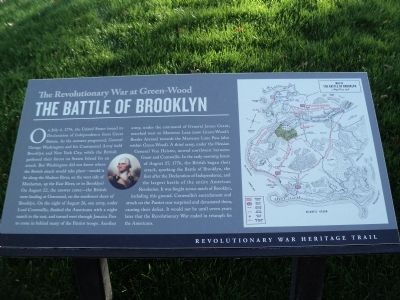
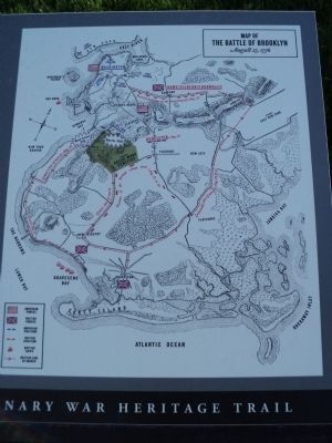
On July 4, 1776, the United States issued its Declaration of Independence from Great Britain. As the summer progressed, General George Washington and his Continental Army held Brooklyn and New York City, while the British gathered their forces on Staten Island for an attack. But Washington did not know where the British attack would take place – would it be along the Hudson River, on the west side of Manhattan, up the East River, or in Brooklyn? On August 22, the answer came – the British were landing at Gravesend, on the southwest shore of Brooklyn. On the night of August 26, one army, under Lord Cornwallis, flanked the Americans with a night march to the east, and turned west through Jamica Pass to come in behind many of the Patriot troops. Another army, under the command of General James Grant, marched west on Martense Lane (now Green-Wood’s Border Avenue) towards the Martense Lane Pass (also within Green-Wood). A third army, under the Hessian General Von Heister, moved northwest between Grant and Cornwallis. In the early morning hours of August 27, 1776, the British began their attack, sparking the Battle of Brooklyn, the first after the Declaration of Independence, and the largest battle of the entire American Revolution. It was fought across much of Brooklyn, including this ground. Cornwallis’s encirclement and attack on the Patriot rear surprised and devastated them, causing their defeat. It would not be until seven years later that the Revolutionary War ended in triumph for the Americans.
Revolutionary War Heritage Trail
Topics. This historical marker is listed in this topic list: War, US Revolutionary. A significant historical date for this entry is July 4, 1776.
Location. 40° 39.426′ N, 73° 59.399′ W. Marker is in Brooklyn, New York, in Kings County. It is in Greenwood Heights. Marker is at the intersection of Battle Avenue and Border Avenue, on the left when traveling north on Battle Avenue. Marker is in Green-Wood Cemetery. Touch for map. Marker is in this post office area: Brooklyn NY 11232, United States of America. Touch for directions.
Other nearby markers. At least 8 other markers are within walking distance of this marker. A different marker also named The Battle of Brooklyn (here, next to this marker); McDonald (a few steps from this marker); Civil War Soldiers’ Monument (a few steps from this marker); Huntington’s Regiment (within shouting distance of this marker); Triumph on Battle Hill (within shouting distance of this marker); Battle Hill (within shouting distance of this marker); Altar to Liberty (within shouting distance of this marker); Van Ness-Parsons Family Tomb (about 400 feet away, measured in a direct line). Touch for a list and map of all markers in Brooklyn.
More about this marker. A portrait of General George Washington appears on the left of the marker. The right side contains a map of the Battle of Brooklyn indicating the positions of the American and British troops, British ships and the British line of march.
Also see . . .
1. Battle of Long Island, August 27, 1776. (Submitted on October 20, 2013, by Bill Coughlin of Woodland Park, New Jersey.)
2. The Battle of Long Island 1776. A British perspective of the battle from BritishBattles.com. (Submitted on October 20, 2013, by Bill Coughlin of Woodland Park, New Jersey.)

Photographed By Bill Coughlin, October 20, 2013
3. Marker in Green-Wood Cemetery
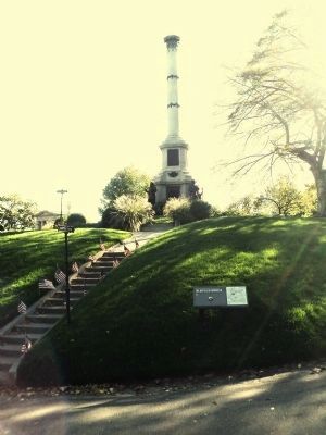
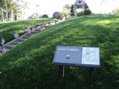
The marker is located on Battle Hill, the highest natural point in Brooklyn. It was here that the Americans had their greatest success during the August 27, 1776 Battle of Brooklyn. The Americans inflicted more casualties on the British on this hill than were experienced everywhere else during the battle.
Credits. This page was last revised on January 31, 2023. It was originally submitted on October 20, 2013, by Bill Coughlin of Woodland Park, New Jersey. This page has been viewed 1,016 times since then and 116 times this year. Photos: 1, 2, 3, 4. submitted on October 20, 2013, by Bill Coughlin of Woodland Park, New Jersey.


