Fillmore in Millard County, Utah — The American Mountains (Southwest)
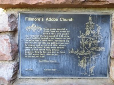
Fillmore's Adobe Church
Erected 1980 by East Millard County, Daughters of Utah Pioneers. (Marker Number 408.)
Topics and series. This historical marker is listed in this topic list: Churches & Religion. In addition, it is included in the Daughters of Utah Pioneers series list. A significant historical year for this entry is 1854.
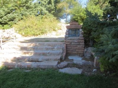
Location. 38° 58.769′ N, 112° 19.322′ W. Marker is in Fillmore, Utah, in Millard County. Marker can be reached from East 500 North, 0.2 miles east of Main Street. Marker is hidden in the northeast corner of Fillmore City Park. Touch for map. Marker is in this post office area: Fillmore UT 84631, United States of America. Touch for directions.
Other nearby markers. At least 8 other markers are within 8 miles of this marker, measured as the crow flies. Dominguez - Escalante Trail (about 400 feet away, measured in a direct line); Capitol (about 400 feet away); Fillmore Pioneer Fort (approx. ¾ mile away); Utah’s First Capitol (approx. 0.8 miles away); Land of the Yuta (approx. 0.9 miles away); Edward Partridge, Jr. House (approx. 0.9 miles away); Little Rock Schoolhouse (approx. 0.9 miles away); Chief Walkara (approx. 7.7 miles away). Touch for a list and map of all markers in Fillmore.
Credits. This page was last revised on June 16, 2016. It was originally submitted on October 21, 2013, by Bill Kirchner of Tucson, Arizona. This page has been viewed 444 times since then and 18 times this year. Photos: 1, 2. submitted on October 21, 2013, by Bill Kirchner of Tucson, Arizona. • Syd Whittle was the editor who published this page.

