Near Fallon in Churchill County, Nevada — The American Mountains (Southwest)
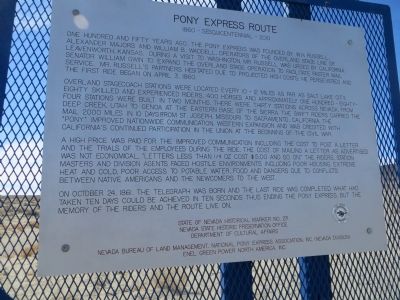
Pony Express Route
1860 - Sesquicentennial - 2010
Overland stagecoach stations were located every 10-12 miles as far as Salt Lake City. Eighty skilled and experienced riders, 400 horses and approximately one hundred-eighty-four stations were built in two months. There were thirty stations across Nevada from Utah to Genoa at the eastern base of the Sierra. The swift riders carried the mail 2,000 miles in 10 days from St. Joseph, Missouri to Sacramento, California. The "Pony" improved nationwide communication, western expansion and was credited with California's continued participation in the Union at the beginning of the Civil War.
A high price was paid for the improved communication, including the cost to post a letter and the trials of the employees during the ride. The cost of mailing a letter as advertised was not economical, "letters less than 1/4 oz cost $5.00 and so on." The riders, station masters and division agents faced hostile environments including poor housing, extreme heat and cold, poor access to potable water, food and dangers due to the conflicts between Native Americans and the newcomers to the west.
On October 24, 1861, the telegraph was born and the last ride was completed. What had taken ten days could be achieved in ten seconds thus ending the Pony Express. But the memory of the riders and the route live on.
Erected 2011 by Nevada State Historic Preservation Office, Department of Cultural Affairs, Nevada Bureau of Land Management, National Pony Express Association, Inc. Nevada Division, Enel Green Power North America, Inc. (Marker Number 271.)
Topics and series. This historical marker is listed in this topic list: Communications. In addition, it is included in the Pony Express National Historic Trail series list. A significant historical month for this entry is April 1968.
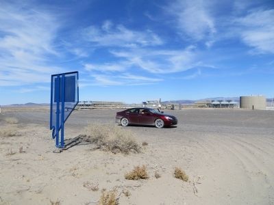
Location. 39° 17.595′ N, 118° 34.431′ W. Marker is near Fallon, Nevada, in Churchill County. Marker can be reached from Salt Wells Road, 6˝ miles south of U.S. 50. Salt Wells Road is approximately 14 miles east of Fallon, NV and the Marker is behind the Enel Salt Wells Power Plant, 6-1/2 miles south of US 50. Touch for map. Marker is in this post office area: Fallon NV 89406, United States of America. Touch for directions.
Other nearby markers. At least 8 other markers are within 9 miles of this marker, measured as the crow flies. Helicopter Antisubmarine Squadron Four Crash Site (approx. 6.4 miles away); Sand Mountain Pony Express Station (approx. 8.3 miles away); Grimes Point Archaeological Area (approx. 8.4 miles away); Rock Art & Game Trails (approx. 8.4 miles away); Grimes Point (approx. 8˝ miles away); Ensuring Success (approx. 8˝ miles away); Lasting Impressions (approx. 8˝ miles away); Beachfront Property (approx. 8˝ miles away). Touch for a list and map of all markers in Fallon.
Credits. This page was last revised on June 16, 2016. It was originally submitted on October 24, 2013, by Bill Kirchner of Tucson, Arizona. This page has been viewed 739 times since then and 28 times this year. Photos: 1, 2, 3. submitted on October 24, 2013, by Bill Kirchner of Tucson, Arizona. • Syd Whittle was the editor who published this page.


