Near Gulf Shores in Baldwin County, Alabama — The American South (East South Central)
Battery Thomas (1898-1917)
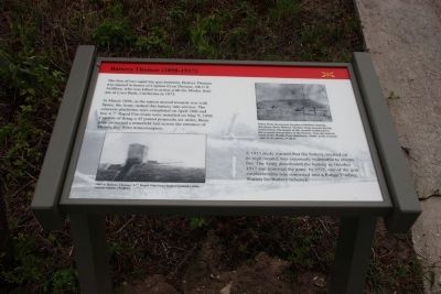
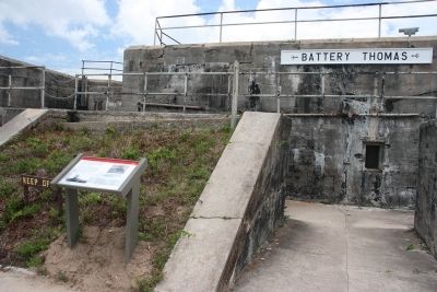
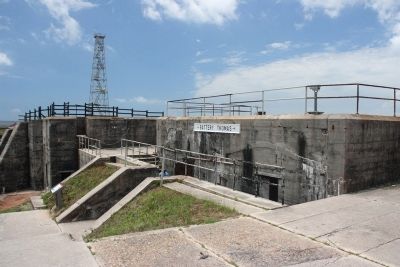
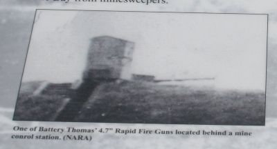
The first of two rapid fire gun batteries, Battery Thomas was named in honor of Captain Evan Thomas, 4th U.S. Artillery, who was killed in action with the Modoc Indians at Lava Beds, California in 1873.
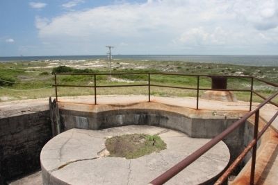
In March 1898, as the nation moved towards war with Spain, the Army rushed this battery into service. The concrete platforms were completed on April 26th and two 4.7” Rapid Fire Guns were installed on May 9, 1898. Capable of firing a 45 pound projectile six miles, these guns protected a minefield laid across the entrance of Mobile Bay from minesweepers.
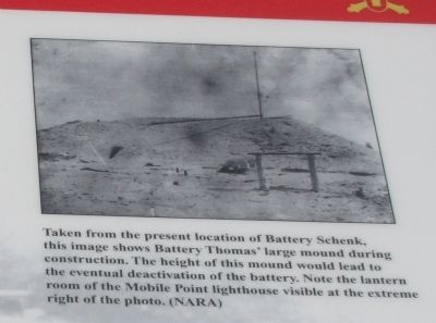
A 1915 study warned that the battery, located on its high Mounds, was extremely vulnerable to enemy fire. The Army deactivated the battery in October 1917 and removed the guns. In 1919, one of the gun emplacements was converted into a Range Finding Station for Battery Schenck.
Topics. This historical marker is listed in this topic list: Forts and Castles. A significant historical month for this entry is March 1898.
Location. 30° 13.74′ N, 88° 1.407′ W. Marker is near Gulf Shores, Alabama, in Baldwin County. Marker can be reached from Fort Morgan Road (State Road 180) 1.7 miles west of Dune Drive. Located on the grounds of Fort Morgan State Historic Park. Touch for map. Marker is at or near this postal address: 51 Highway 180 West, Gulf Shores AL 36542, United States of America. Touch for directions.
Other nearby markers. At least 8 other markers are within walking distance of this marker. Battery Schenck (1899-1923) (within shouting distance of this marker); U.S. Model 1918M1 155mm Gun and Model 1918A1 Carriage (within shouting distance of this marker); 6.4” (100 pounder) Parrott Rifle / 7” Brooke Rifle (about 300 feet away, measured in a direct line); The Citadel (about 300 feet away); The Battle of Mobile Bay (about 300 feet away); Fort Bowyer War of 1812 (about 300 feet away); First Battle of Fort Bowyer (about 300 feet away); Second Battle of Fort Bowyer (about 300 feet away). Touch for a list and map of all markers in Gulf Shores.
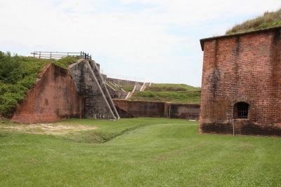
More about this marker. Battery Thomas is located to the right of the entrance into historic Fort Morgan.
Photographed By Timothy Carr, June 19, 2013
6. Photo Image Right:
Taken from the present location of Battery Schenk, this image shows Battery Thomas’ large mound during construction. The height of this mound would lead to the eventual deactivation of the battery. Note the lantern room of the Mobile Point lighthouse visible at the extreme right of the photo. (NARA)
Credits. This page was last revised on July 25, 2018. It was originally submitted on October 29, 2013, by Timothy Carr of Birmingham, Alabama. This page has been viewed 1,084 times since then and 46 times this year. Photos: 1, 2, 3, 4, 5, 6, 7. submitted on October 29, 2013, by Timothy Carr of Birmingham, Alabama. • Bernard Fisher was the editor who published this page.
