Galveston in Galveston County, Texas — The American South (West South Central)
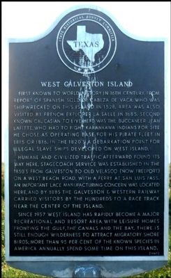
West Galveston Island
First known to world history in the 16th century, from report of Spanish soldier Cabeza de Vaca, who was shipwrecked on this island in 1528. Area was also visited by French explorer La Salle in 1685. Second known Caucasian to live here was the buccaneer Jean Lafitte, who had to fight Karankawa Indians for the site he chose as operating base for his pirate fleet in 1815 or 1816. In the 1820's a debarkation point for illegal slave ships developed on West Island.
Humane and civilized traffic afterward found its way here. Stagecoach service was established in the 1850's from Galveston to Old Velasco (now Freeport) on a West Beach road, with a ferry at San Luis Pass. An important lace manufacturing concern was located here, and by 1885 the Galveston & Western Railway carried visitors by the hundreds to a race track near the center of the island.
Since 1957 West Island has rapidly become a major recreational and resort area, with leisure homes fronting the Gulf, the canals and the bay. There is still enough wilderness to attract migratory shore birds; more than 95 per cent of the known species in America annually spend some time on this island.
Erected 1967 by State Historical Survey Committee. (Marker Number 11591.)
Topics. This historical marker is listed in these topic lists: Exploration • Settlements & Settlers. A significant historical year for this entry is 1528.
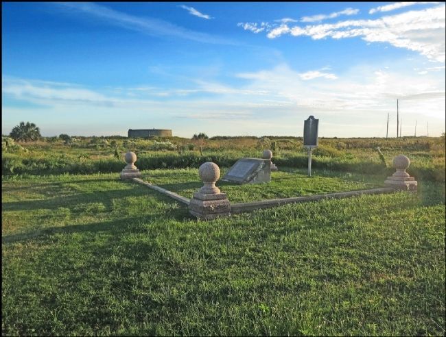
Location. 29° 11.856′ N, 94° 57.01′ W. Marker is in Galveston, Texas, in Galveston County. Marker is on 13 Mile Road, 0.1 miles south of Termini-San Luis Pass Road (County Route 3005), on the right when traveling south. The marker is located in Galveston Island State Park. Touch for map. Marker is in this post office area: Galveston TX 77554, United States of America. Touch for directions.
Other nearby markers. At least 8 other markers are within 9 miles of this marker, measured as the crow flies. Lafitte's Grove (approx. 1.4 miles away); Karankawa Campsite (approx. 2 miles away); Site of Magnolia Grove Cemetery (approx. 7.6 miles away); Galveston "News", C.S.A. (approx. 7.9 miles away); The Galveston Daily News (approx. 7.9 miles away); Campbell's Bayou (approx. 7.9 miles away); Original Site of St. Mary's Orphan Asylum (approx. 8.4 miles away); Rosewood Cemetery (approx. 8.7 miles away). Touch for a list and map of all markers in Galveston.
Credits. This page was last revised on July 15, 2022. It was originally submitted on November 11, 2013, by Jim Evans of Houston, Texas. This page has been viewed 816 times since then and 33 times this year. Last updated on July 11, 2022, by Joe Lotz of Denton, Texas. Photos: 1, 2, 3. submitted on November 11, 2013, by Jim Evans of Houston, Texas. • J. Makali Bruton was the editor who published this page.


