Jackson in Amador County, California — The American West (Pacific Coastal)
Martell Stage Station
Inscription.
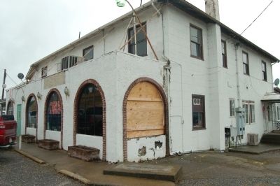
Started about 100 years ago as Ryanís Station. In 1888 became known as Martellís Station. This was the main terminal for stagecoaches from Amador County gold mines. Large shipments of gold bullion were made from Martellís Station to San Francisco, and supplies for the mines were transported back through Martellís Station.
Chapter No. 49
E Clampus Vitus
Erected 1966 by E Clampus Vitus, James W, Marshall 49.
Topics and series. This historical marker is listed in this topic list: Railroads & Streetcars. In addition, it is included in the E Clampus Vitus series list. A significant historical year for this entry is 1888.
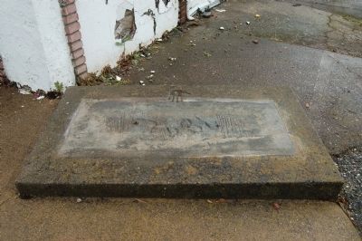
Location. Marker has been reported missing. It was located near 38° 22.02′ N, 120° 47.757′ W. Marker was in Jackson, California, in Amador County. Marker was at the intersection of Golden Chain Highway (California Route 49) and Martell Road, on the left when traveling north on Golden Chain Highway. Touch for map. Marker was at or near this postal address: 10901 California Highway 49, Jackson CA 95642, United States of America. Touch for directions.
Other nearby markers. At least 8 other markers are within walking distance of this location. Anthony Caminetti (approx. half a mile away); Jackson (approx. half a mile away); Argonaut Mine (approx. half a mile away); The Kennedy Mine / The Argonaut Mine (approx. half a mile away); University of California Foothill Field Station (approx. half a mile away); Argonaut and Kennedy Mines (approx. half a mile away); Amador County Veterans' Memorial (approx. half a mile away); Amador Ledger (approx. half a mile away). Touch for a list and map of all markers in Jackson.
More about this marker. This marker and its monument were the victims of a traffic accident and were removed.
Also see . . . Martell - Amador Gold.net. This webpage displays a photo of the original Martell Stage Station marker. (Submitted on November 14, 2013, by Barry Swackhamer of Brentwood, California.)
Credits. This page was last revised on June 16, 2016. It was originally submitted on November 14, 2013, by Barry Swackhamer of Brentwood, California. This page has been viewed 670 times since then and 47 times this year. Photos: 1, 2. submitted on November 14, 2013, by Barry Swackhamer of Brentwood, California. • Al Wolf was the editor who published this page.

