Mexico in Audrain County, Missouri — The American Midwest (Upper Plains)
Mexico
[Side A]
Internationally known for its firebrick industry and famed for its saddle horses, this county seat was laid out by Robert C. Mansfield and James H. Smith not long before Audrain County was organized, 1836. Named for legislator James H. Audrain and settled mainly by Southerners, the county lies in the Little Dixie Region of Missouri.
Rex McDonald, one of the world's greatest saddle horses, whose blood line has played an important part in the development of the easy-gaited, graceful American Saddle Horse, was foaled at nearby Auxvasse, 1890. He is buried at the fairgrounds in Mexico. Here lived famed Negro trainer Tom Bass and here he trained Belle Beach, champion high schooled mare. Mexico claims the first $1,500 saddle horse show ring and the first $1,000 trotting and pacing stakes. It was early a harness racing center.
Fireclay deposits mined here are among the largest and purest known, and Mexico is one of the leading firebrick producing centers in the world. Refactories are also at Vandalia and Farber. Located here is a huge soybean storage and processing plant.
(See other side)
[Side B]
(Continued from other side)
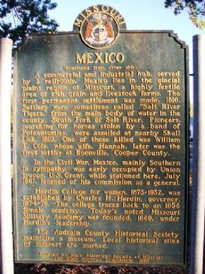
A commercial and industrial hub, served by 3 railroads, Mexico lies in the glacial plains region of Missouri, a highly fertile area of rich grain and livestock farms. The first permanent settlement was made, 1816. Settlers were sometimes called "Salt River Tigers," from the main body of water in the county, South Fork of Salt River. Pioneers, searching for horses stolen by a band of Potawatomies, were assailed at nearby Skull Lick, 1810. One of those killed was William T. Cole, whose wife, Hannah, later was the first settler at Boonville, Cooper County.
In the Civil War, Mexico, mainly Southern in sympathy, was early occupied by Union troops. U.S. Grant, while stationed here, July 1861, learned of his commission as a general.
Hardin College for women, 1873-1932, was established by Charles H. Hardin, governor, 1874-1876. The college traces back to an 1858 female academy. Today's noted Missouri Military Academy was founded, 1889, under Hardin's leadership.
The Audrain County Historical Society maintains a museum. Local historical sites of interest are marked.
Erected 1955 by State Historical Society of Missouri and State Highway Commission.
Topics and series. This historical marker is listed in these topic lists: Education • Industry & Commerce • Settlements & Settlers. In addition, it is included in the Former U.S. Presidents: #18 Ulysses S. Grant, and the Missouri, The State Historical Society of series lists. A significant historical month for this entry is July 1861.
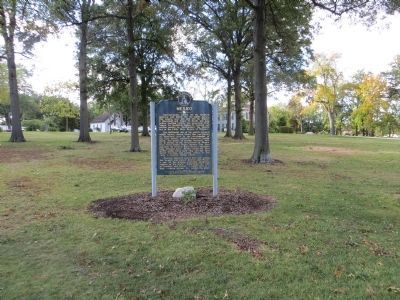
Location. 39° 10.064′ N, 91° 53.334′ W. Marker is in Mexico, Missouri, in Audrain County. Marker is at the intersection of Mudrow Street (Missouri Route 15) and Hisey Street, on the right when traveling south on Mudrow Street. Marker is at the southeast corner of Robert S. Green Park. Touch for map. Marker is at or near this postal address: 501 South Mudrow Street, Mexico MO 65265, United States of America. Touch for directions.
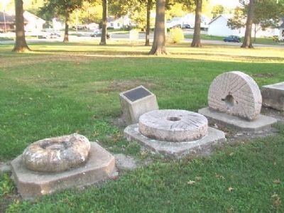
Other nearby markers. At least 8 other markers are within walking distance of this marker. Old Stones (within shouting distance of this marker); Hardin College Bell (about 300 feet away, measured in a direct line); Old Courthouse Clock Bell (about 300 feet away); Bean Creek German Evangelical Church and Littleby Methodist Church Bell (about 300 feet away); Graceland (about 300 feet away); Rex McDonald 833 (about 400 feet away); Diaspore Boulder (about 500 feet away); Bonnot Combined Brick Machine (about 500 feet away). Touch for a list and map of all markers in Mexico.
Also see . . . Audrain County Historical Society, MO. (Submitted on November 30, 2013, by William Fischer, Jr. of Scranton, Pennsylvania.)
Credits. This page was last revised on June 16, 2016. It was originally submitted on November 30, 2013, by William Fischer, Jr. of Scranton, Pennsylvania. This page has been viewed 785 times since then and 34 times this year. Photos: 1, 2, 3. submitted on November 30, 2013, by William Fischer, Jr. of Scranton, Pennsylvania. 4. submitted on November 6, 2014, by Bill Kirchner of Tucson, Arizona.


