Mt. Vernon in Mobile County, Alabama — The American South (East South Central)
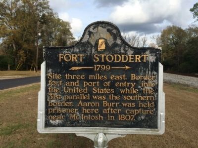
Fort Stoddert
– 1799 →
Erected 1949 by Historic Mobile Preservation Society.
Topics. This historical marker is listed in this topic list: Forts and Castles. A significant historical year for this entry is 1807.
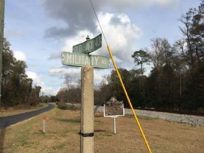
Location. 31° 5.154′ N, 88° 0.977′ W. Marker is in Mt. Vernon, Alabama, in Mobile County. Marker is at the intersection of Military Road (County Road 96) and Old Highway 43, on the left when traveling east on Military Road. Touch for map. Marker is at or near this postal address: 1020 Military Road, Mount Vernon AL 36560, United States of America. Touch for directions.
Other nearby markers. At least 8 other markers are within 4 miles of this marker, measured as the crow flies. Mt. Vernon Federal Highway (within shouting distance of this marker); Mount Vernon Historical Museum and Train Depot (about 700 feet away, measured in a direct line); Mt. Vernon Arsenal and Barracks/Searcy Hospital (approx. half a mile away); Mount Vernon Arsenal (approx. half a mile away); Old Military Road and Old Federal Road (approx. 1.3 miles away); Ephraim Kirby's Grave (approx. 2.1 miles away); a different marker also named Fort Stoddert (approx. 2.1 miles away); St. Peter the Apostle Catholic Church (approx. 3.3 miles away). Touch for a list and map of all markers in Mt. Vernon.
Credits. This page was last revised on June 25, 2017. It was originally submitted on December 5, 2013, by Mark Hilton of Montgomery, Alabama. This page has been viewed 1,160 times since then and 74 times this year. Photos: 1, 2, 3, 4. submitted on December 5, 2013, by Mark Hilton of Montgomery, Alabama. • Bernard Fisher was the editor who published this page.


