McIntosh in Washington County, Alabama — The American South (East South Central)
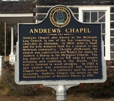
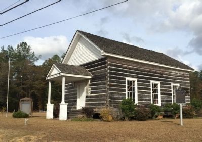
Andrews Chapel
Erected by Alabama Historical Commission.
Topics and series. This historical marker is listed in this topic list: Churches & Religion. In addition, it is included in the Alabama Historical Commission series list. A significant historical year for this entry is 1860.
Location. 31° 15.725′ N, 88° 1.815′ W. Marker is in McIntosh, Alabama, in Washington County. Marker is at the intersection of Jefferson Davis Highway (U.S. 43) and John Johnston Road (County Road 35), on the right when traveling north on Jefferson Davis Highway. Touch for map. Marker is at or near this postal address: 7554 Jefferson Davis Hwy, Mc Intosh AL 36553, United States of America. Touch for directions.
Other nearby markers. At least 8 other markers are within 13 miles of this marker, measured as the crow flies. Town of McIntosh (approx. 0.4 miles away); MOWA Band of Choctaw Indians (approx. 8.6 miles away); Mt. Nebo Death Masks (approx. 11.2 miles away); Mount Vernon Arsenal (approx. 12 miles away); Mt. Vernon Arsenal and Barracks/Searcy Hospital (approx. 12 miles away); Old Military Road and Old Federal Road (approx. 12.2 miles away); Ephraim Kirby's Grave (approx. 12.2 miles away); Fort Stoddert (approx. 12.2 miles away).
Credits. This page was last revised on June 16, 2016. It was originally submitted on December 5, 2013, by Mark Hilton of Montgomery, Alabama. This page has been viewed 568 times since then and 29 times this year. Photos: 1, 2, 3. submitted on December 5, 2013, by Mark Hilton of Montgomery, Alabama. • Bernard Fisher was the editor who published this page.


