Camden in Kershaw County, South Carolina — The American South (South Atlantic)
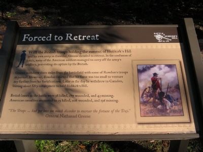
Forced to Retreat
Greene withdrew three miles from the battlefield with some of Rawdon’s troops in pursuit. However, Rawdon believed that his force was too small to venture any farther from his fortifications. Later in the day he withdrew to Camden, leaving about fifty cavalrymen to hold Hobkirk’s Hill.
British losses in the battle were 38 killed, 177 wounded, and 43 missing. American casualties amounted to 25 killed, 108 wounded, and 136 missing.
“The Troops … had got into too much disorder to recover the fortune of the Day.” General Nathanael Greene
Topics. This historical marker is listed in this topic list: War, US Revolutionary.
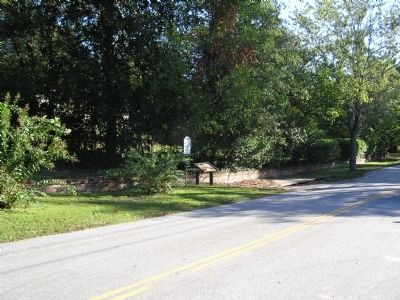
Location. 34° 15.865′ N, 80° 36.396′ W. Marker is in Camden, South Carolina, in Kershaw County. Marker is on Greene Street near ., on the left when traveling east. Touch for map. Marker is in this post office area: Camden SC 29020, United States of America. Touch for directions.
Other nearby markers. At least 8 other markers are within walking distance of this marker. Struggle for the Hill (about 500 feet away, measured in a direct line); Battle Of Hobkirk Hill (about 600 feet away); William Washington's Ride (about 600 feet away); A Final Encounter (about 700 feet away); Greene's Counterblow (about 700 feet away); Fruitless Victory (about 700 feet away); Battle of Hobkirk Hill (about 700 feet away); General Greene's Headquarters (approx. 0.2 miles away). Touch for a list and map of all markers in Camden.
Credits. This page was last revised on June 16, 2016. It was originally submitted on October 24, 2011, by Anna Inbody of Columbia, South Carolina. This page has been viewed 468 times since then and 15 times this year. Last updated on December 17, 2013, by David Graff of Halifax, Nova Scotia. Photos: 1, 2, 3. submitted on October 24, 2011, by Anna Inbody of Columbia, South Carolina. • Bernard Fisher was the editor who published this page.


