Aqc Commercial Subdivision in Austin in Travis County, Texas — The American South (West South Central)
Waters Park
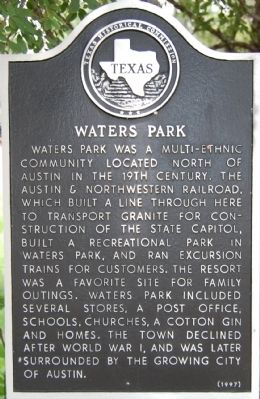
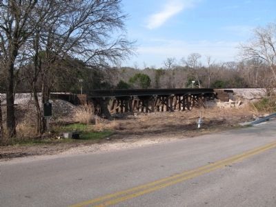
Waters Park was a multi-ethnic community located north of Austin in the 19th century. The Austin & Northwestern Railroad, which built a line through here to transport granite for construction of the state capitol, built a recreational park in Waters Park, and ran excursion trains for customers. The resort was a favorite site for family outings. Waters Park included several stores, a post office, schools, churches, a cotton gin and homes. The town declined after World War I, and was later surrounded by the growing city of Austin.
Erected 1996 by Texas Historical Commission. (Marker Number 12250.)
Topics. This historical marker is listed in these topic lists: Entertainment • Railroads & Streetcars • Settlements & Settlers.
Location. 30° 24.936′ N, 97° 42.605′ W. Marker is in Austin, Texas, in Travis County. It is in Aqc Commercial Subdivision. Marker is on Waters Park Road, 0.2 miles south of Adelphi Lane, on the right when traveling south. Touch for map. Marker is in this post office area: Austin TX 78759, United States of America. Touch for directions.
Other nearby markers. At least 8 other markers are within 4 miles of this marker, measured as the crow flies. St. Stephen’s Missionary Baptist Church (approx. 0.6 miles away); Walnut Creek Baptist Church (approx. 2.3 miles away); The Gault Homestead (approx. 2.6 miles away); Merrilltown Cemetery (approx. 2.8 miles away); Texas Newspapers, C.S.A. (approx. 3.2 miles away); 700 Year Old Live Oak (approx. 3.4 miles away); The Old Zimmerman Home (approx. 3.6 miles away); Oertli Dairy (approx. 3.8 miles away). Touch for a list and map of all markers in Austin.
Also see . . .
1. Handbook of Texas Online. Waters Park (Submitted on January 21, 2010, by Keith Peterson of Cedar Park, Texas.)
2. Walnut Crossing Neighborhood Association. Link to article providing additional history on Waters Park. The marker is today located on Waters Park Road which follows what in the 1800s was called Upper Georgetown Road and was the main route from Austin to Georgetown and points north. (Submitted on January 3, 2014, by Richard Denney of Austin, Texas.)
Additional commentary.
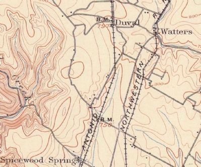
1. Waters vs. Watters Park
Some maps and literature use the spelling Watters Park
— Submitted January 3, 2014, by Richard Denney of Austin, Texas.

Photographed By Richard Denney, December 26, 2013
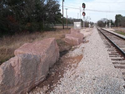
3. Granite blocks from derailments at Waters Park
As described in the Handbook of Texas Online, the Austin and Northwestern Railroad, which passes here, was used to transport granite blocks from Granite Mountain near Burnet to the Austin construction site of the new state Capitol. Large granite blocks still lying in the railroad right-of-way testify to derailments at Waters Park.
Credits. This page was last revised on February 1, 2023. It was originally submitted on January 21, 2010, by Keith Peterson of Cedar Park, Texas. This page has been viewed 1,805 times since then and 65 times this year. Last updated on March 8, 2021, by Richard Denney of Austin, Texas. Photos: 1. submitted on January 21, 2010, by Keith Peterson of Cedar Park, Texas. 2. submitted on December 26, 2013, by Richard Denney of Austin, Texas. 3, 4. submitted on January 3, 2014, by Richard Denney of Austin, Texas. • J. Makali Bruton was the editor who published this page.


