Londonderry in Derry And Strabane, Northern Ireland, United Kingdom — Northwestern Europe (the British Isles)
… Free, entire and perfect
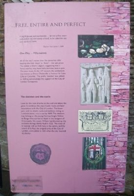
A city fit for war and merchandise…for ever a free, entire and perfect city and county of itself, to be called the city and county of Derrie.
Charter from James I, 1604
One City…Fifty Names
All of the city's names over the centuries refer back to the Irish 'daire' or 'doire' - the oak grove. The oldest is Daire Calgach, suggesting that a fierce warrior may have had a fortress here in pre-Christian times. In the 12th century the settlement was known as Doire Cholmcille to honour St Colm Cille or Columba. The prefix 'London' was added in 1613 to acknowledge the support of the City of London Companies.
The skeleton and the castle
Look for the coat of arms on the wall and above the gates. It combines the city's Gaelic roots and later associations with the City of London. The lower part, with its shield, castle and skeleton sitting on 'a mossie stone', was in use by 1600. The skeleton may belong to the young Norman knight Walter de Burgo who starved to death in the dungeon of Greencastle. His cousin William had blocked up the entrance during a family feud in 1322. The cross of St George with an Irish harp in the centre, and the sword of St Paul, the original arms of the City of London, were added in 1613 when the city received its charter.
Topics. This historical marker is listed in this topic list: Settlements & Settlers. A significant historical year for this entry is 1604.
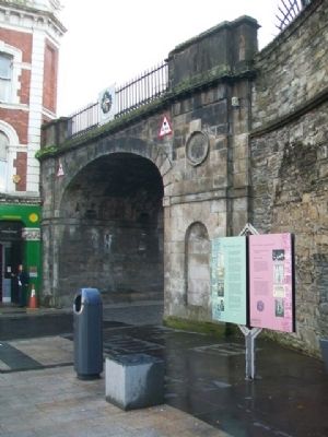
Location. 54° 59.828′ N, 7° 19.197′ W. Marker is in Londonderry, Northern Ireland, in Derry And Strabane. Marker is at the intersection of Shipquay Place and Guildhall Square, on the right when traveling west on Shipquay Place. Marker is near the Shipquay Gate of the City Wall. Touch for map. Marker is at or near this postal address: 1A Shipquay Pl, Londonderry, Northern Ireland BT48 6LU, United Kingdom. Touch for directions.
Other nearby markers. At least 8 other markers are within walking distance of this marker. The Walled City (here, next to this marker); Guildhall Square (here, next to this marker); War Memorial (here, next to this marker); Shipquay Gate (here, next to this marker); Demi-culverin Cannon (a few steps from this marker); a different marker also named Demi-culverin Cannon (a few steps from this marker); Michael Browning (a few steps from this marker); a different marker also named Guildhall Square (within shouting distance of this marker).
Also see . . .
1. History of Derry, Northern Ireland. (Submitted on December 27, 2013, by William Fischer, Jr. of Scranton, Pennsylvania.)
2. City of Derry. (Submitted on December 27, 2013, by William Fischer, Jr. of Scranton, Pennsylvania.)
Credits. This page was last revised on September 16, 2022. It was originally submitted on December 27, 2013, by William Fischer, Jr. of Scranton, Pennsylvania. This page has been viewed 547 times since then and 7 times this year. Photos: 1, 2. submitted on December 27, 2013, by William Fischer, Jr. of Scranton, Pennsylvania.

