Near Sisters in Deschutes County, Oregon — The American West (Northwest)
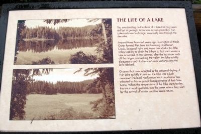
The Life of a Lake
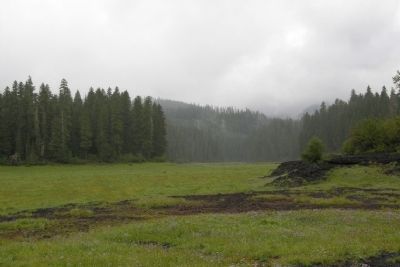
Around three thousand years ago an eruption of Nash Crater formed Fish Lake by damming Hackleman Creek. Seasonal rains and snow overwhelm this little valley's ability to drain the inflow so that each winter a lake is formed. In the summer, after the last snow melts off the ridges overlooking the valley, the lake quickly disappears and Hackleman Creek vanishes into the lava lakebed.
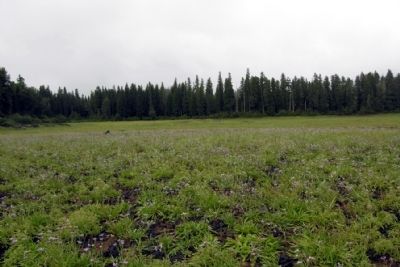
Grasses that have adapted to the seasonal drying of Fish Lake quickly transformed the lake into a lush meadow. The local Hackleman trout population has adapted to this seasonal disappearance of their lake home. When the temperature of the lake starts to rise, the trout head upstream into the creek where they wait for the arrival of winter and the lake's return.
Erected by United States Forest Service.
Topics. This historical marker is listed in this topic list: Notable Places.
Location. 44° 24.053′ N, 122° 0.255′ W. Marker is near Sisters, Oregon, in Deschutes County. Marker can be reached from McKenzie Highway (Oregon Route 126) 1.6 miles south of U.S. 20, on the right when traveling south. Marker is accessed by a Forest Service road on the west side of State Route 126 approx. 1.6 miles south of US 20; the marker is 0.1 miles down the Forest Service road. Touch for map. Marker is in this post office area: Sisters OR 97759, United States of America. Touch for directions.
Other nearby markers. At least 7 other markers are within 15 miles of this marker, measured as the crow flies. Time Traveler (within shouting distance of this marker); Pioneer Mailman (approx. 13.3 miles away); Wisely Reasoned (approx. 14 miles away); A Fittin' Tribute (approx. 14 miles away); Dee Wright Observatory (approx. 14 miles away); Old Wagon Road (approx. 14 miles away); Scott Road (approx. 14.6 miles away).
Credits. This page was last revised on June 16, 2016. It was originally submitted on December 28, 2013, by Duane Hall of Abilene, Texas. This page has been viewed 452 times since then and 14 times this year. Photos: 1, 2. submitted on December 21, 2012, by Duane Hall of Abilene, Texas. 3. submitted on December 28, 2013, by Duane Hall of Abilene, Texas.
Editor’s want-list for this marker. Wide-view photo of marker and its surroundings. • Can you help?


