Anoka in Anoka County, Minnesota — The American Midwest (Upper Plains)
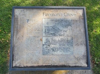
Fireman's Grove
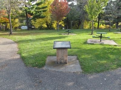
Fireman's Grove is located here in the area just above the confluence of the Rum River. It was named for the firemen who pastured their horses at The Point. Fireman's Grove became a favorite gathering place for townspeople and visitors who enjoyed picnics and Fourth of July celebrations here under the white pines.
unreadable text ...in 1864... picnics... at The Point. These all day events included the parade and brass band, patriotic speeches... the cool shade of the grove, on nature's green carpet, or at crude tables improvised for the occasion, discussed the bountiful supplies of good things provided. The band discoursed more excellent music, and the gathering quietly dispersed.
unreadable text ...village.
Topics. This historical marker is listed in this topic list: Notable Places. A significant historical year for this entry is 1864.
Location. 45° 11.485′ N, 93° 23.474′ W. Marker is in Anoka, Minnesota, in Anoka County. Marker can be reached from South Ferry Road, 0.3 miles east of South Ferry Street (U.S. 169). Marker is in Peninsula Point Park. Touch for map. Marker is at or near this postal address: 1460 South Ferry Parkway, Anoka MN 55303, United States of America. Touch for directions.
Other nearby markers. At least 8 other markers are within walking distance of this marker. Where Cultures Meet (within shouting distance of this marker); Logbooms Meet Sawmills (within shouting distance of this marker); River Highways (about 300 feet away, measured in a direct line); Where Land and Water Meet (about 300 feet away); Bridging the Mississippi (about 300 feet away); Circle of Life (about 400 feet away); Highway of Exploration (about 400 feet away); Who Lived Here / Neighborhood Names / Building a Community (about 700 feet away). Touch for a list and map of all markers in Anoka.
Credits. This page was last revised on October 13, 2020. It was originally submitted on December 29, 2013, by Keith L of Wisconsin Rapids, Wisconsin. This page has been viewed 814 times since then and 24 times this year. Photos: 1, 2, 3. submitted on December 29, 2013, by Keith L of Wisconsin Rapids, Wisconsin.


