Derry-Londonderry in Derry And Strabane, Northern Ireland, United Kingdom — Northwestern Europe (the British Isles)
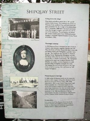
Shipquay Street
Living above the 'shop'
Many banks and offices started life as 18th and 19th century family houses. The building at the corner of Shipquay Street and Bank Place was both home and place of business for the manager of the Belfast Bank. On 7th December 1888 there was much excitement when the manager's daughter gave birth to a son in one of the bedrooms. The son became the famous 20th century novelist Joyce Cary. Childhood holidays in Inishowen inspired his prize-winning 'House of Children' (1941).
The tragic runaway
In 1759 Shipquay Street witnessed the start of one of Ireland's most romantic tragedies. Eighteen year old Mary Ann Knox of Prehen House had fallen in love with her father's friend, John McNaghten, a gambler twice her age. The couple secretly 'married' in a house on Shipquay Street. Realising that McNaghten was after her dowry rather than her hand, her father planned to remove Mary to Dublin in November, 1761. McNaghten ambushed the coach near Strabane and shot Mary. Whether an accident, a crime of passion or a cold-blooded killing, McNaghten swung for the crime. The hanging had to be carried out twice as the rope broke at the first attempt. He is still known as 'half-hanged McNaghten'.
Measuring up to marriage
In 1828 number 8 Shipquay Street was the scene of a romance with a happier ending when Elizabeth Hester Boyd married Lt Col Thomas Colby (1784-1852). Appointed in 1824 to map Ireland, Colby chose Lough Foyle to establish the 13 kilometer baseline for his survey. His innovative measuring system using three metre long compensation bars was extremely accurate. When the distance was re-calculated using electronic equipment in the 1960s the difference in the two measurements was only 2.5 centimetres. Colby became the first Director of the Ordnance Survey in Ireland.
A steep story
Some people boast that Shipquay Street may be the steepest shopping thoroughfare in Ireland or even in Europe. Its steep slope lies behind the tongue-twister: Shipquay Street is a slippery street to slide on.
Topics. This historical marker is listed in these topic lists: Arts, Letters, Music • Education • Exploration • Settlements & Settlers. A significant historical month for this entry is November 1761.
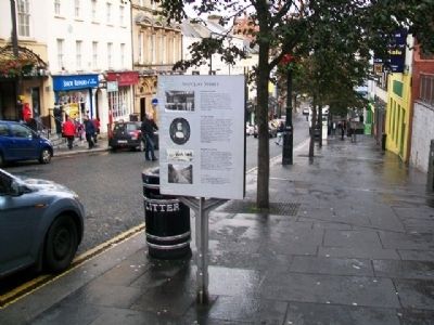
Location. 54° 59.793′ N, 7° 19.23′ W. Marker is in Derry-Londonderry, Northern Ireland, in Derry And Strabane. Marker is on Shipquay Street near Castle Street, on the right when traveling north. Touch for map. Marker is at or near this postal address: 15 Shipquay Street, Derry-Londonderry, Northern Ireland BT48 6DW, United Kingdom. Touch for directions.
Other nearby markers. At least 8 other markers are within walking distance of this marker. Arthur Joyce Lunel Cary (within shouting distance of this marker); Shipquay Gate
(within shouting distance of this marker); a different marker also named Shipquay Gate (within shouting distance of this marker); The Walled City (within shouting distance of this marker); … Free, entire and perfect (within shouting distance of this marker); Guildhall Square (within shouting distance of this marker); War Memorial (within shouting distance of this marker); Demi-culverin Cannon (within shouting distance of this marker). Touch for a list and map of all markers in Derry-Londonderry.
Also see . . .
1. Arthur Joyce Lunel Cary (1888-1957). (Submitted on January 5, 2014, by William Fischer, Jr. of Scranton, Pennsylvania.)
2. Cartography and Utilitarianism versus Culture: Thomas Colby of the Ordnance Survey of Ireland. (Submitted on January 5, 2014, by William Fischer, Jr. of Scranton, Pennsylvania.)
Credits. This page was last revised on August 27, 2020. It was originally submitted on January 5, 2014, by William Fischer, Jr. of Scranton, Pennsylvania. This page has been viewed 646 times since then and 62 times this year. Photos: 1, 2. submitted on January 5, 2014, by William Fischer, Jr. of Scranton, Pennsylvania.

