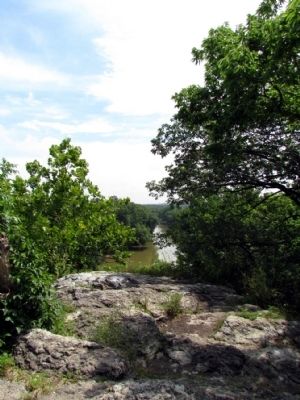
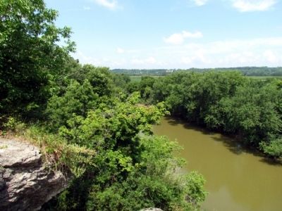
Near Lagro in Wabash County, Indiana — The American Midwest (Great Lakes)
Hanging Rock
National Natural Landmark
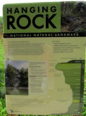
The Legend of Hanging Rock
Wy-nu-sa was a beautiful Miami Indian maiden who thought she was in love with two handsome, strong, stalwart Indian braves. Both of the young men were deeply in love with the maiden, too, but she was not able to decide which of them she wished to marry. So the young maiden, Wy-nu-sa, called for a duel to be held at the top of Hanging Rock, where the winner of the fight would have her hand in marriage.
The two young men agreed to the plan. On a moonlit night they climbed to the top of Hanging Rock to fight for the love of the beautiful young maiden, who sat nearby to watch the duel. Wy-nu-sa secretly loved one of the braves more than the other one, but never admitted this to anyone, not even to herself. The battle raged on until finally one brave fell over the edge of the rock to his death below. The victorious brave walked over to claim Wy-nu-sa as his bride, but he was not the one she loved. Distraught, she plunged to her own death, and is believed to be with her true love in the happy hunting grounds.
Fun Facts
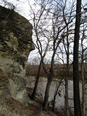
Height of Hanging Rock is 65 feet
Utilized by Native Americans as a lookout point
Recognized since the early 1900s as a rare exposure
National Natural Landmark since 1986
Acquired by ACRES Land Trust in 2008
Hanging Rock displays three different types of rock. Each formed in a different environment in the Silurian seascape:
Hard, Massive Dolomite
Table-like cap rock
Probably represents a small part of the active reef, but convincing fossils are scarce
Dolomitization, the process of limestone being converted to dolomite, has chemically altered all of Hanging Rock to some degree
Well-Bedded Fossiliferous Limestone and Dolomite
Make up the large middle section of Hanging Rock
These flank beds dip steeply away from the core of the reef (now removed by erosion)
Consists of coral sand and larger reef fragements
Soft, Dolomitic Siltstone
Blacky gray rock at the base of the pinnacle
Consists of silt and clay particles cemented together by dolomite
Deposited in quiet water at the bottom of the sea before the reef appeared
420 Million Years of Geologic History
The Upper Wabash Valley displays some of the best examples of ancient reefs in North America
Bedrock was deposited about 420 million years ago, during the Silurian period, when north-central Indiana was geographically located about 15° south of the equator
With the midcontinent covered by a shallow sub-tropical sea, corals, bryozoans, and other hard-shelled organisms flourished and built many small, pinnacle-like reefs that stood just below sea level
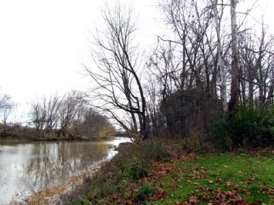
Hanging Rock is an erosional remnant of one such reef that formerly stood where the river now flows
Geologic Time Scale
1859–Lagro founded
Quaternary Period–Hanging Rock exposed by Maumee Torrent
Tertiary Period–Weathering and erosion of Indiana landscapes
Cretaceous Period–The Age of Reptiles: Dinosaurs dominate life on earth
Permian Period–Vast coal swamps, sandstone, shale and limestone
Silurian Period–Hanging Rock bedrock deposited in a shallow, tropical sea
Precambrian Period–Volcanic activity
Erected by ACRES Land Trust.
Topics and series. This historical marker is listed in this topic list: Notable Places. In addition, it is included in the National Natural Landmarks series list. A significant historical year for this entry is 1986.
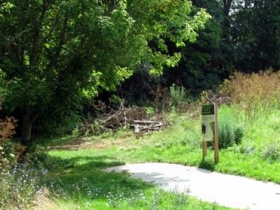
Location. 40° 49.796′ N, 85° 42.444′ W. Marker is near Lagro, Indiana, in Wabash County. Marker can be reached from E. Hanging Rock Road, 0.8 miles east of State Road 524, on the left when traveling east. Touch for map. Marker is in this post office area: Lagro IN 46941, United States of America. Touch for directions.
Other nearby markers. At least 8 other markers are within 6 miles of this marker, measured as the crow flies. The Wabash River (a few steps from this marker); Kerr Lock (approx. 1.1
miles away); St. Patrick's Roman Catholic Church (approx. 1.3 miles away); Dallas Township World War II Roll of Honor (approx. 5.9 miles away); Hanna Park (approx. 5.9 miles away); The Wabash River and the Big Four Cut (approx. 6.1 miles away); Kin-Com-A-Ong Spring (approx. 6.1 miles away); Cleveland, Cincinnati, Chicago & St. Louis Railway (approx. 6.1 miles away). Touch for a list and map of all markers in Lagro.
Credits. This page was last revised on June 16, 2016. It was originally submitted on August 25, 2013, by Duane Hall of Abilene, Texas. This page has been viewed 1,868 times since then and 122 times this year. Last updated on January 16, 2014, by Willard McKinzie of Huntington, Indiana. Photos: 1, 2, 3, 4, 5, 6. submitted on August 25, 2013, by Duane Hall of Abilene, Texas. • Bill Pfingsten was the editor who published this page.
