Wilson in Niagara County, New York — The American Northeast (Mid-Atlantic)
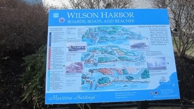
Wilson Harbor
Boards, Boats, and Beaches
Present: Marinas, Camps, Pleasure Craft
Pleasure Boat Port
1999 Wilson Boathouse remodeled and New Community Center and Marina built
1990 Boat Launch and Docks Built at State Park
1980 Sport Fishing Dominates Harbor Activity
1960 Wilson-Tuscarora State Park Established.
1950 Steel and Concrete Piers Built
1950 Boathouse Restaurant Opened
1875-1920: Resorts, Hotels, Cottages. Shore erosion and flooding caused the east branch to break through to the lake around 1900.
Resort Center
1905 Jacob Miller improves Maple Grove Park as a cottage community
1900 Olcott Beach Hotel built
1895 July 24, Steamer 'Arguyle' made 2 round trips to Toronto.
1895 June 13, Boat lands 450 people at park
1895 June 10,First boat of the season at park with 250 people.
1894 July 16, Steamer from Toronto ties up with 900 people aboard.
1894 July 10, Charter boat from Toronto brings 700 people to picnic.
1890s Pittsburgh Hotel built.
1891 Shipping apples, peaches, grapes, grain, wool, lumber, and coal. Great oak forests depleted. 1876 The schooner 'Union" built.
1845-1875: Shipbuilding, Logging. First Piers built by Luther Wilson in 1846.
Resource Extraction
1875 The 'Trader' and the 'Plowboy' built.
1867 The 'Live Oak' built.
1866 The 'Pilot" built.
1963 The 'Meteor', 'Fleetwing', and 'Eureka' built.
1862 The 'Active' built.
1854 The 'Bell Adkins' built.
1852 The 'Josephine' built. 1850 The 'Enterprise' built. 1849 The 'Almira' and the 'Forest' built. 1848 Wilson became Port of Entry
1848 The 'Emblem' built.
1847 The 'Niagara' built.
1846 The R.F. Wilson' built.
1817 Oak logs shipped to England to build warships.
1817 'Ontario' first steamboat to visit Wilson.
The O-SO-EZE. This naptha powered boat ferried people from the mainland to the island, and also cruised the lake for short excursions.
Photo of Wilson Boathouse circa 1910.
The Pittsburgh Hotel. This was one of many hotels serving vacationers, so many from Pittsburgh that at one time Wilson was called a Pittsburgh resort.
The 'Fleetwing' was one of several schooners built here to carry passengers and freight to and from the harbor.
Maritime Heritage. Ideal Harbor Conditions are the Attraction that Sustains this Seaway Trail port.
Erected by
Seaway Trail, Inc. Corner Ray & West Main St., Sackets Harbor, NY 13685 1-800-SEAWAY-T.
Topics and series. This historical marker is listed in this topic list: Industry & Commerce. In addition, it is included in the Great Lakes Seaway Trail National Scenic Byway series list. A significant historical year for this entry is 1817.
Location. 43° 19.022′ N, 78° 50.041′ W. Marker is in Wilson, New York, in Niagara County. Marker is on Ontario Street, on the left when traveling west. Marker is at the terminus of Ontario Street, off NY route 18. Touch for map. Marker is in this post office area: Wilson NY 14172, United States of America. Touch for directions.
Other nearby markers. At least 8 other markers are within walking distance of this marker. Port of Entry Marker and Wilson Boat House (about 300 feet away, measured in a direct line); The Government Piers at Twelve Mile Creek, Wilson, New York (about 400 feet away); Lake Island Park, Wintergreen Island, Tugwell Island & Clark Island (approx. ¼ mile away); a different marker also named Lake Island Park (approx. ¼ mile away); Park and Harbor Streets (approx. 0.3 miles away); Greenwood Veterans' Memorial Park (approx. 0.3 miles away); Vietnam Memorial in Memory of 1st Lt. Michael E. Witkop (approx. 0.4 miles away); A Solemn Tribute to the Men and Women of Wilson who Served (approx. 0.4 miles away). Touch for a list and map of all markers in Wilson.
More about this
Photographed By Anton Schwarzmueller, January 14, 2014
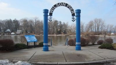
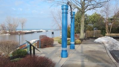
3. Wilson Harbor Marker and Pier
Harbor opens to Lake Ontario. The west pier is attached to Sunset Island. The sidewalk leads to the east pier which is paved, but typically extremely icy in winter. The Toronto skyline can be seen from the pier, weather permitting.
Photographed By Anton Schwarzmueller, January 14, 2014
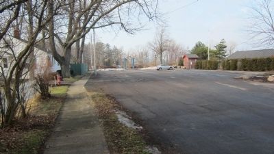
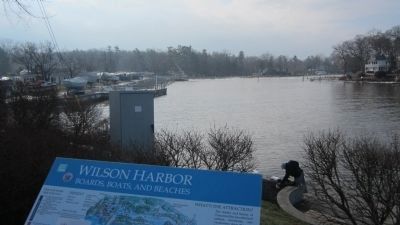
5. Wilson Harbor and Marker
Sunset Island is across the harbor to the right. It is not actually an island because it is tethered to the mainland by breakwalls. Treasure Island (aka: Clark Island) is hard to the left; home of the Tuscarora Yacht Club.
Photographed By Anton Schwarzmueller, January 14, 2014
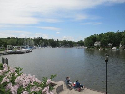
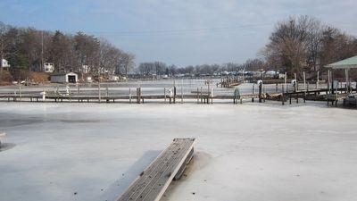
6. Wilson Harbor Towards Marker
This northeast view towards the marker is from Sunset Bay Marina on O'Connell Island behind the Sunset Grill. Sunset Island is to the left. Follow the tree line from the left and you will notice a break from closer trees to a few more distant trees. That break is the harbor exit to the left. The marker and arch cannot be seen due to picture resolution.
Credits. This page was last revised on May 2, 2021. It was originally submitted on January 31, 2014, by Anton Schwarzmueller of Wilson, New York. This page has been viewed 559 times since then and 33 times this year. Photos: 1, 2, 3, 4, 5, 6. submitted on January 31, 2014, by Anton Schwarzmueller of Wilson, New York. 7. submitted on June 22, 2014, by Anton Schwarzmueller of Wilson, New York. • Bill Pfingsten was the editor who published this page.
