Pike Road in Montgomery County, Alabama — The American South (East South Central)
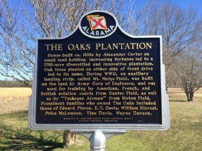
The Oaks Plantation
Erected 2011 by the East Montgomery County Historical Society & the Alabama Historical Association.
Topics and series. This historical marker is listed in these topic lists: African Americans • Settlements & Settlers • War, World II. In addition, it is included in the Alabama Historical Association series list.
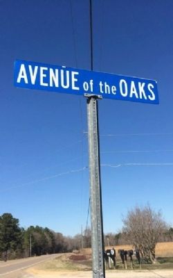
Location. 32° 21.434′ N, 86° 2.707′ W. Marker is in Pike Road, Alabama, in Montgomery County. Marker is at the intersection of Marler Road (County Route 107) and Avenue of the Oaks, on the left when traveling south on Marler Road. The Avenue of the Oaks is a private road. Touch for map. Marker is at or near this postal address: 500 Avenue of the Oaks, Pike Road AL 36064, United States of America. Touch for directions.
Other nearby markers. At least 8 other markers are within 5 miles of this marker, measured as the crow flies. Lucas Tavern (approx. 0.6 miles away); Lucas Hill Cemetery (approx. 1.6 miles away); Grace Episcopal Church (approx. 2.9 miles away); Georgia Washington School (approx. 3.3 miles away); Antioch Baptist Church (approx. 3.4 miles away); Chantilly Plantation (approx. 3.6 miles away); Prairie Farms Resettlement Community (approx. 3.7 miles away); Brewer Memorial Church (approx. 4.4 miles away). Touch for a list and map of all markers in Pike Road.
Also see . . . The Oaks Plantation web site. (Submitted on February 27, 2014, by Mark Hilton of Montgomery, Alabama.)
Credits. This page was last revised on June 16, 2016. It was originally submitted on February 27, 2014, by Mark Hilton of Montgomery, Alabama. This page has been viewed 1,219 times since then and 106 times this year. Photos: 1, 2, 3. submitted on February 27, 2014, by Mark Hilton of Montgomery, Alabama. • Bernard Fisher was the editor who published this page.


