Rich Hill in Bates County, Missouri — The American Midwest (Upper Plains)
The Town That Coal Built
Rich Hill, Missouri
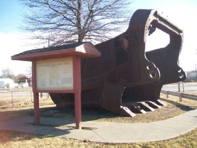
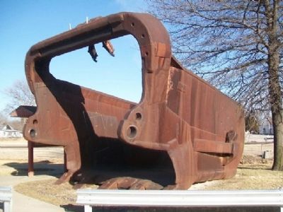
— "Big Mouth" —
Inscription.
Marion 8200-5 Walking Dragline
"Midway Princess"
Total Working Weight • 6,800,000 Pounds
Boom Length • 275 Feet
Boom Angle • 35 [degrees]
Maximum Digging Depth • 125 Feet
Operation Radius • 251 Feet
Bucket Capacity • 73 Cubic Yards
Bucket Weight • 40 to 44 Tons
Average Length of Step • 7.0 Feet
Electrical Requirements • 800,000 KWH/Month (normal)
We would like to thank P&M Coal Company for their generous donation of this 73 cubic yard bucket from the "Princess" coal shovel to the city of Rich Hill, Missouri.
"Big Mouth" was moved here from Amoret, Missouri on June 21, 1993. This bucket could not have been moved without generous donations of time and labor of P&M Employees, P&E Erection Company and S-Corts Service.
Erected by City of Rich Hill.
Topics. This historical marker is listed in these topic lists: Industry & Commerce • Natural Resources • Settlements & Settlers. A significant historical month for this entry is June 1861.
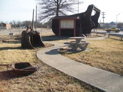
Location. 38° 5.798′ N, 94° 21.677′ W. Marker is in Rich Hill, Missouri, in Bates County. Marker is at the intersection of 7th Street and Park Street, on the left when traveling south on 7th Street. Marker and shovel are in Caboose Park. Touch for map. Marker is in this post office area: Rich Hill MO 64779, United States of America. Touch for directions.
Other nearby markers. At least 8 other markers are within 11 miles of this marker, measured as the crow flies. Harmony Mission (approx. 0.4 miles away); Bates County, Missouri in 1862 (approx. 10.4 miles away); Prairie Fire and the Battle of Island Mound (approx. 10.4 miles away); The Battle of Island Mound: A Demonstration to the Nation (approx. 10.6 miles away); First Kansas Colored Volunteer Infantry Regimental History (approx. 10.6 miles away); The Battle of Island Mound (approx. 10.6 miles away); The Toothman Farm (approx. 10.6 miles away); Battle of Island Mound Memorial (approx. 10.6 miles away).
More about this marker. The marker and photos are quite faded.
Related markers. Click here for a list of markers that are related to this marker.
Also see . . .
1. Coal mining key part of Rich Hill's history. Nevada Daily Mail website entry (Submitted on March 2, 2014, by William Fischer, Jr. of Scranton, Pennsylvania.)
2. Marion Power Shovel Company. Tractor & Construction Plant Wiki entry (Submitted on March 2, 2014, by William Fischer, Jr. of Scranton, Pennsylvania.)
3. Peabody Energy. Wikipedia entry (Submitted on April 22, 2022, by Larry Gertner of New York, New York.)
Credits. This page was last revised on April 22, 2022. It was originally submitted on March 2, 2014, by William Fischer, Jr. of Scranton, Pennsylvania. This page has been viewed 1,352 times since then and 68 times this year. Photos: 1, 2, 3. submitted on March 2, 2014, by William Fischer, Jr. of Scranton, Pennsylvania.


