Rutledge in Crenshaw County, Alabama — The American South (East South Central)
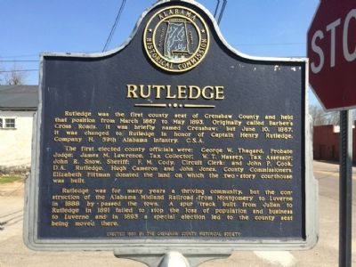
Rutledge
The first elected county officials were: George W. Thagard, Probate Judge; James M. Lawrence, Tax Collector; W.T. Massey, Tax Assessor; John R. Snow, Sheriff; F.M. Cody, Circuit Clerk; and John P. Cook, D.A. Rutledge, Hugh Cameron, and John Jones, County Commissioners. Elizabeth Pittman donated the land on which the two-story courthouse was built.
Rutledge for many years was a thriving community, but the construction of the Alabama Midland Railroad from Montgomery to Luverne in 1888 by-passed the town. A spur track built from Julian to Rutledge in 1891 failed to stop the loss of population and business to Luverne and in 1893 a special election led to the county seat being moved there.
Erected 1990 by the Crenshaw County Historical Society.
Topics. This historical marker is listed in these topic lists: Railroads & Streetcars • Settlements & Settlers. A significant historical month for this entry is March 1867.
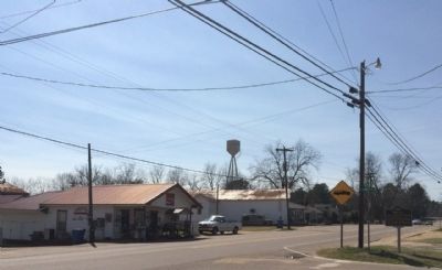
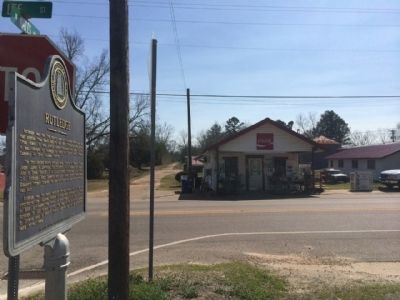
Location. 31° 43.829′ N, 86° 18.601′ W. Marker is in Rutledge, Alabama, in Crenshaw County. Marker is at the intersection of Lee Street (State Road 10) and North Watts Avenue, on the right when traveling west on Lee Street. Touch for map. Marker is at or near this postal address: 1606 Lee Street, Rutledge AL 36071, United States of America. Touch for directions.
Other nearby markers. At least 8 other markers are within 12 miles of this marker, measured as the crow flies. Rutledge Primitive Baptist Church (approx. 0.6 miles away); Crenshaw County Courthouse (approx. 3 miles away); The Bricken Building (approx. 3 miles away); Luverne Historic District (approx. 3 miles away); Douglass House (approx. 3 miles away); New Providence Primitive Baptist Church Site (approx. 8.6 miles away); Elam Primitive Baptist Church (approx. 11 miles away); Goshen Substation (approx. 11.1 miles away).
Credits. This page was last revised on June 16, 2016. It was originally submitted on March 2, 2014, by Mark Hilton of Montgomery, Alabama. This page has been viewed 910 times since then and 61 times this year. Photos: 1, 2, 3, 4. submitted on March 2, 2014, by Mark Hilton of Montgomery, Alabama. • Bernard Fisher was the editor who published this page.


