Emeryville in Alameda County, California — The American West (Pacific Coastal)
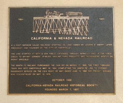
California & Nevada Railroad
1884 – 1903
The line started at 40th and San Pablo, extended through Berkeley and up San Pablo Creek to Bryant (Orinda) 23 miles hauling farm products and passengers mostly on picnic specials.
The Santa Fe Railway purchased the C&N RR on March 17, 1903. The first through train ran into Emeryville May 16, 1904, completing the Santa Fe line to Chicago. Passenger service on the C&N right of way ended June 15, 1958 and freight service was discontinued on May 12, 1979
Erected 1998 by California-Nevada Railroad Historical Society.
Topics. This historical marker is listed in this topic list: Railroads & Streetcars. A significant historical date for this entry is March 17, 1903.
Location. 37° 50.426′ N, 122° 17.519′ W. Marker is in Emeryville, California, in Alameda County. Marker can be reached from Horton Street near 59th Street, on the left when traveling north. Touch for map. Marker is at or near this postal address: 5885 Horton Street, Emeryville CA 94608, United States of America. Touch for directions.
Other nearby markers. At least 8 other markers are within walking distance of this marker. Shell Mound Park (approx. ¼ mile away); PCR Park (approx. 0.4 miles away); Northern Railway (approx. 0.4 miles away); Emeryville’s Horse Racetrack (approx. 0.4 miles away); Emeryville’s Mexican Heritage (approx. half a mile away); Two Emeryville Pioneers (approx. half a mile away); In Memoriam (NSGW WWI Memorial) (approx. 0.6 miles away); Judson Manufacturing (approx. 0.6 miles away). Touch for a list and map of all markers in Emeryville.
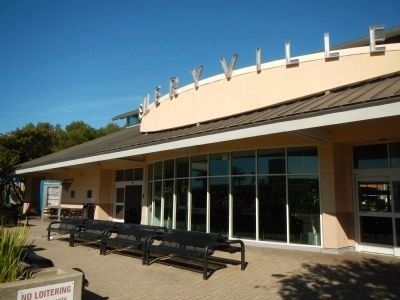
More about this marker. This marker is found on the track side of the Amtrak Station.
Also see . . . California and Nevada Railroad - Wikipedia. The California and Nevada Railroad was a 3 ft (914 mm) narrow gauge steam railroad which ran in the East Bay of the San Francisco Bay Area in the late 19th century. It was incorporated on March 25, 1884. J.S. Emery was listed as the railroad's president, for which present day Emeryville is named. On March 1, 1885 the track was completed between Oakland and San Pablo via Emeryville. (Submitted on March 18, 2014, by Barry Swackhamer of Brentwood, California.)
Credits. This page was last revised on June 16, 2016. It was originally submitted on March 18, 2014, by Barry Swackhamer of Brentwood, California. This page has been viewed 812 times since then and 34 times this year. Photos: 1, 2. submitted on March 18, 2014, by Barry Swackhamer of Brentwood, California. • Syd Whittle was the editor who published this page.

