Eisenhower East in Alexandria, Virginia — The American South (Mid-Atlantic)
The Duke Street Tanyard
Alexandria Heritage Trail
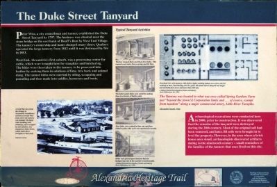
West End, Alexandria's first suburb, was a processing center for cattle, which were brought here for slaughter and butchering. The hides were then taken to the tannery to be processed into leather by soaking them in solutions of lime, tree bark, and animal dung. The tanned hides were curried by oiling, scrapping, and pounding and then made into saddles, harness and boots.
"The Tannery was located in what was once called Spring Gardens Farm just "beyond the [town's] Corporation limits and... of course, exempt from taxation" along a major commercial artery, Little River Turnpike." — Alexandria Gazette, 1844.
Archaeological excavations were conducted here in 2000, prior to construction. It was discovered that the remains of the tanyard were destroyed during the 20th century. Most of the original soil had been removed, and later, fill soils were brought in to level the property. However, in the area where a brick house once stood, archaeologists discovered artifacts dating to the nineteenth century — small reminders of the families of the tanners that once lived on this site.
Erected by Th Marriott Corporation in cooperation with Alexandria Museum Office of Historic Alexandria.
Topics and series. This historical marker is listed in this topic list: Industry & Commerce. In addition, it is included in the Virginia, The City of Alexandria series list. A significant historical year for this entry is 1797.
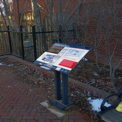
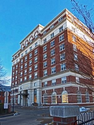
Location. 38° 48.234′ N, 77° 3.481′ W. Marker is in Alexandria, Virginia. It is in Eisenhower East. Marker can be reached from the intersection of Duke Street (Virginia Route 236) and Daingerfield Road, on the right when traveling east. The marker is in a small park just west of The Marriott Residence Inn along Hooff's Run. It stands in the Eisenhower East neighborhood of Alexandria. Touch for map. Marker is at or near this postal address: 1456 Duke Street, Alexandria VA 22314, United States of America. Touch for directions.
Other nearby markers. At least 8 other markers are within walking distance of this marker. The West End (within shouting distance of this marker); Hooff's Run Bridge (about 300 feet away, measured in a direct line); The Edmonson Sisters (about 500 feet away); African American Heritage Memorial (about 600 feet away); A National Cemetery System (about 800 feet away); "Pursuers of Booth the Assassin" (approx. 0.2 miles away); Shiloh Baptist Church (approx. 0.2 miles away); In Honor of Those Who Gave the Ultimate Sacrifice (approx. 0.2 miles away). Touch for a list and map of all markers in Alexandria.
Also see . . . Alexandria Heritage Trail. (Submitted on March 21, 2014, by Allen C. Browne of Silver Spring, Maryland.)
Photographed By Allen C. Browne, March 8, 2014
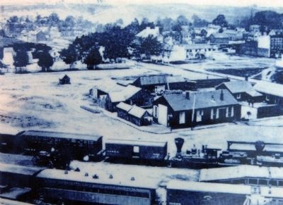
3. Civil War View
A Civil War view from the Orange & Alexandria roundhouse northwest toward West End, where the tannery was located. The large white building with chimneys, once occupied by slave dealers, was situated on Duke Street, called Little River Turnpike in West End.Close-up of photo on marker
National Archives
National Archives
Photographed By Allen C. Browne, March 8, 2014
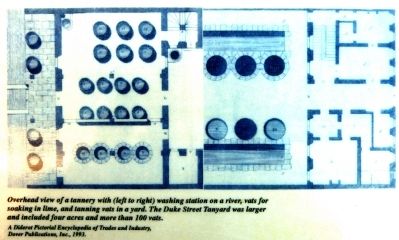
4. Overhead View of a Tannery
Overhead view of a tannery with (left to right) washing station on a river, vats for soaking in lime, and tanning vats in a yard. The Duke Street Tanyard was larger and included four acres and more than 100 vats.Close-up of image on marker
Diderot Pictorial Encyclopedia, Dover, 1993
Diderot Pictorial Encyclopedia, Dover, 1993
Credits. This page was last revised on January 27, 2023. It was originally submitted on March 21, 2014, by Allen C. Browne of Silver Spring, Maryland. This page has been viewed 1,505 times since then and 70 times this year. Photos: 1, 2, 3, 4, 5, 6. submitted on March 21, 2014, by Allen C. Browne of Silver Spring, Maryland. • Bernard Fisher was the editor who published this page.
