French Mill in Limestone County, Alabama — The American South (East South Central)
Limestone County Tornado Memorial
Primary marker
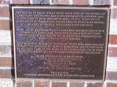
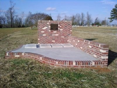
The bricks in these walls were once part of the homes of Limestone Countians. Each one represents a dream, and the loss of that dream on April 27, 2011, when seven tornadoes hit Limestone County and 62 struck in Alabama, killing 247 people, including four locally.
Here, these bricks represent hope and the resilience of a community that came together to help one another recover that day, and in the wake of all tornadoes in Limestone County's history.
This memorial was built to ensure those who died are not forgotten and that we always remember the outpouring of aid that came in the wake of the tornadoes, from next-door neighbors and from strangers across the nation.
United Way of Limestone County
Precision Masonry
Bethel Church of Christ
Rotary Club
The family of Jan Turner McElyea
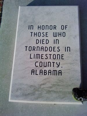
Concrete marker 1
In honor of those who died in tornadoes in Limestone County, Alabama
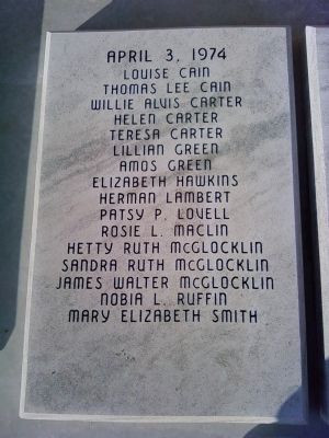
Concrete marker 2
April 3, 1974
Louise Cain Thomas Lee Cain Willie Alvis Carter Helen Carter Teresa Carter Lillian Green Amos Green Elizabeth Hawkins Herman Lambert Patsy P. Lovell Rosie L. Maclin Hetty Ruth McGlocklin Sandra Ruth McGlocklin James Walter McGlocklin Nobia L. Ruffin Mary Elizabeth Smith
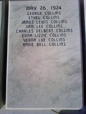
Concrete marker 3
May 26, 1924
George Collins Ethel Collins James Lewis Collins Sam Lee Collins Charles Delbert Collins Edna Lizzie Collins Verna Lue Collins Annie Bell Collins
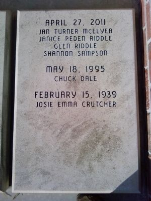
Concrete marker 4
April 27, 2011
Jan Turner McElyea Janice Peden Riddle Glen Riddle Shannon Sampson
May 18, 1995
Chuck Dale
February 15, 1939
Josie Emma Crutcher
Erected 2012 by Tornado Remembrance and Awareness Committee.
Topics. This historical marker and memorial is listed in this topic list: Disasters. A significant historical month for this entry is February 1952.
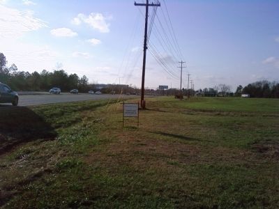
Location. 34° 45.898′ N, 86° 52.382′ W. Marker is in French Mill, Alabama, in Limestone County. Marker is on Lee Highway (U.S. 72) 0.3 miles east of Mooresville Road (County Route 71), on the right when traveling west. Monument is located in front of Bethel Cemetery. Touch for map. Marker is in this post office area: Athens AL 35613, United States of America. Touch for directions.
Other nearby markers. At least 8 other markers are within 6 miles of this marker, measured as the crow flies. Cambridge (approx. 1.3 miles away); Cotton Hill (approx. 2.8 miles away); Gamble House (approx. 3.7 miles away); Nicholas Davis (approx. 4.7 miles away); Confederate Circle (approx. 5.8 miles away); Pleasant Hill (approx. 5.8 miles away); Old Town Cemetery (approx. 5.9 miles away); Athens Big Spring Memorial Park (approx. 6 miles away).
Credits. This page was last revised on June 16, 2016. It was originally submitted on March 21, 2014, by Lee Hattabaugh of Capshaw, Alabama. This page has been viewed 1,466 times since then and 83 times this year. Photos: 1. submitted on March 21, 2014, by Lee Hattabaugh of Capshaw, Alabama. 2, 3, 4, 5, 6, 7. submitted on March 22, 2014, by Lee Hattabaugh of Capshaw, Alabama. • Bernard Fisher was the editor who published this page.
