Estancia in Torrance County, New Mexico — The American Mountains (Southwest)
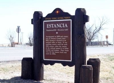
Estancia
Population 1,830 - Elevation 6,107
Topics. This historical marker is listed in this topic list: Settlements & Settlers. A significant historical year for this entry is 1830.
Location. 34° 46.131′ N, 106° 3.324′ W. Marker is in Estancia, New Mexico, in Torrance County. Marker is at the intersection of State Road 41 and Alan Ayers Road, on the right when traveling south on State Road 41. Touch for map. Marker is in this post office area: Estancia NM 87016, United States of America. Touch for directions.
Other nearby markers. At least 4 other markers are within 15 miles of this marker, measured as the crow flies. A different marker also named Estancia (approx. 0.9 miles away); a different marker also named Estancia (approx. one mile away); Homesteader Mary Ellen "Mollie" Hall Warren Klapp 1862-1933 (approx. 10.9 miles away); Laguna Del Perro (approx. 14.1 miles away).
Credits. This page was last revised on June 16, 2016. It was originally submitted on March 30, 2014, by Maribeth Robison of Moriarty, New Mexico. This page has been viewed 571 times since then and 36 times this year. Photo 1. submitted on March 30, 2014, by Maribeth Robison of Moriarty, New Mexico. • Bill Pfingsten was the editor who published this page.
