Mt. Lebanon in Allegheny County, Pennsylvania — The American Northeast (Mid-Atlantic)
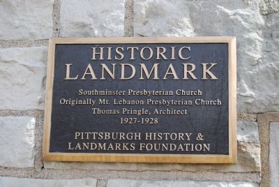
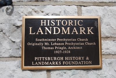
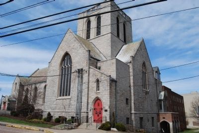
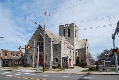
Southminster Presbyterian Church
— Historic Landmark —
Inscription.
Originally Mount Lebanon Presbyterian Church
Thomas Pringle, Architect
1927-1928
Erected by Pittsburgh History and Landmarks Foundation.
Topics and series. This historical marker is listed in these topic lists: Architecture • Churches & Religion. In addition, it is included in the Pennsylvania, Pittsburgh History and Landmarks Foundation series list.
Location. 40° 22.664′ N, 80° 2.762′ W. Marker is in Mt. Lebanon, Pennsylvania, in Allegheny County. Marker can be reached from the intersection of Washington Road (Bypass U.S. 19) and Castle Shannon Boulevard. Touch for map. Marker is in this post office area: Pittsburgh PA 15228, United States of America. Touch for directions.
Other nearby markers. At least 8 other markers are within 3 miles of this marker, measured as the crow flies. Mt. Lebanon Municipal Building (approx. 0.2 miles away); Veterans Memorial (approx. half a mile away); World War Memorial (approx. half a mile away); Saint Bernard Church (approx. 0.6 miles away); a different marker also named Veterans Memorial (approx. 1.2 miles away); Borough of Dormont Pool (approx. 1.3 miles away); Bower Hill (approx. 2.1 miles away); This is the Steepest Street in the Continental United States (approx. 2.3 miles away). Touch for a list and map of all markers in Mt. Lebanon.
Also see . . . Southminster Presbyterian Church. Church website homepage (Submitted on April 6, 2014, by Mike Wintermantel of Pittsburgh, Pennsylvania.)
Credits. This page was last revised on May 22, 2023. It was originally submitted on April 6, 2014, by Mike Wintermantel of Pittsburgh, Pennsylvania. This page has been viewed 645 times since then and 38 times this year. Last updated on April 6, 2014, by Keith S Smith of West Chester, Pennsylvania. Photos: 1, 2, 3, 4. submitted on April 6, 2014, by Mike Wintermantel of Pittsburgh, Pennsylvania. • Bill Pfingsten was the editor who published this page.


