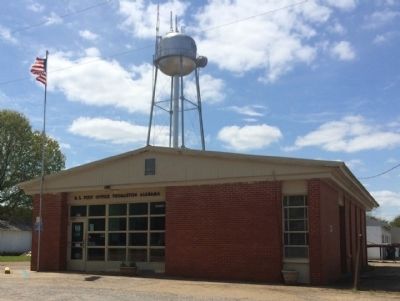
Thomaston in Marengo County, Alabama — The American South (East South Central)
History of the Town of Thomaston
(side 1)
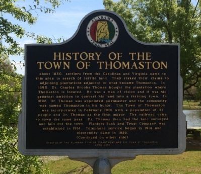
About 1830, settlers from the Carolinas and Virginia came to this area in search of fertile land. They staked their claims to adjoining plantations adjacent to what became Thomaston. In 1890, Dr. Charles Brooks Thomas bought the plantation where Thomaston is located. He was a man of vision and it was his greatest ambition to convert his land into a thriving town. In 1892, Dr. Thomas was appointed postmaster and the community was named Thomaston in his honor. The Town of Thomaston was incorporated in February, 1901 with a population of 51 people and Dr. Thomas as the first Mayor. The railroad came to town the same year. Dr. Thomas then had the land surveyed and laid out the town. Planters Bank and Trust Company was established in 1914. Telephone service began in 1914 and electricity came in 1929.
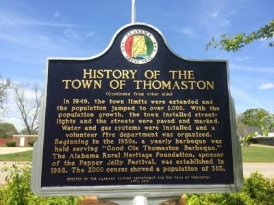
Water and gas systems were installed and a volunteer fire department was organized.
Beginning in the 1950's, a yearly barbeque was held serving “Good Ole Thomaston Barbeque.” The Alabama Rural Heritage Foundation, sponsor of the Pepper Jelly Festival, was established in 1986. The 2000 census showed a population of 383.
Erected 2010 by the Alabama Tourism Department and the Town of Thomaston.
Topics. This historical marker is listed in this topic list: Settlements & Settlers. A significant historical month for this entry is February 1901.
Location. 32° 15.992′ N, 87° 37.625′ W. Marker is in Thomaston, Alabama, in Marengo County. Marker is on 2nd Avenue (Alabama Route 28) 0.1 miles west of Alabama Route 25, on the left when traveling west. Touch for map. Marker is at or near this postal address: 6510 2nd Avenue, Thomaston AL 36783, United States of America. Touch for directions.
Other nearby markers. At least 8 other markers are within 12 miles of this marker, measured as the crow flies. Bethel Baptist Church & Cemetery (approx. 5.6 miles away); Bethel Hill Missionary Baptist Church (approx. 5.8 miles away); Paulling Place Cemetery (approx. 8.4 miles away); History of Linden, Alabama (approx. 10.3 miles away); A County Older Than the State (approx. 10.4 miles away); Old Marengo County Courthouse (approx. 10.6 miles away); St. Michael's Episcopal Churchyard (approx. 11.8 miles away); St. Michael's Cemetery (approx. 11.8 miles away).
Credits. This page was last revised on June 16, 2016. It was originally submitted on April 13, 2014, by Mark Hilton of Montgomery, Alabama. This page has been viewed 644 times since then and 37 times this year. Photos: 1, 2, 3, 4, 5. submitted on April 13, 2014, by Mark Hilton of Montgomery, Alabama. • Bernard Fisher was the editor who published this page.
