Locust Grove in Washington County, Maryland — The American Northeast (Mid-Atlantic)
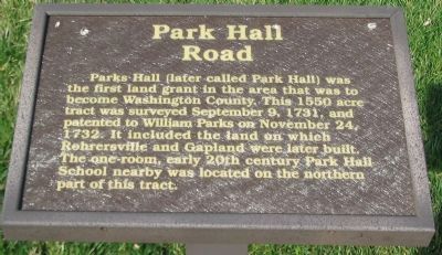
Park Hall Road
Erected by Washington County Historic District Commission.
Topics and series. This historical marker is listed in this topic list: Settlements & Settlers. In addition, it is included in the Maryland, Washington County Historical Advisory Committee series list. A significant historical date for this entry is September 9, 1731.
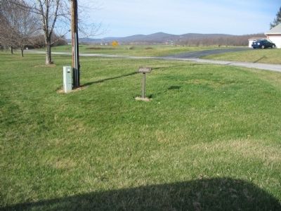
Location. 39° 27.232′ N, 77° 39.875′ W. Marker is in Locust Grove, Maryland, in Washington County. Marker is at the intersection of Rohrersville Road (State Highway 67) and Park Hall Road, on the right when traveling south on Rohrersville Road. Touch for map. Marker is in this post office area: Rohrersville MD 21779, United States of America. Touch for directions.
Other nearby markers. At least 8 other markers are within 3 miles of this marker, measured as the crow flies. Felfoot Bridge (approx. 2 miles away); North Carolina (approx. 2.7 miles away); The Lost Orders (approx. 2.8 miles away); The Maryland Campaign of 1862 (approx. 2.8 miles away); The Battle for Fox’s Gap (approx. 2.8 miles away); Deaths of Two Generals (approx. 2.8 miles away); Welcome to Historic Wise's Field (approx. 2.8 miles away); Near Here in Wise’s Field (approx. 2.8 miles away).
Credits. This page was last revised on June 16, 2016. It was originally submitted on April 24, 2008, by Craig Swain of Leesburg, Virginia. This page has been viewed 1,095 times since then and 11 times this year. Photos: 1, 2. submitted on April 24, 2008, by Craig Swain of Leesburg, Virginia.

