Near Grayson in Carter County, Kentucky — The American South (East South Central)
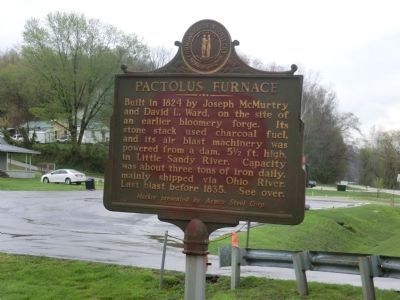
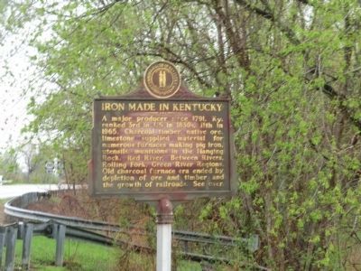
Pactolus Furnace / Iron Made in Kentucky
Built in 1824 by Joseph McMurtry and David L. Ward, on the site of an earlier bloomer forge. Its stone stack used charcoal fuel, and its air blast machinery was powered from a dam, 5 1/2 ft. high, in Little Sandy River. Capacity was about three tons of iron daily, mainly shipped via Ohio River. Last blast before 1835.
Marker presented by Armco Steel Corp.
A major producer since 1791, Ky. ranked 3rd in US in 1830s, 11th in 1965. Charcoal timber, native ore, limestone supplied material for numerous furnaces making pig iron, utensils, munitions in the Hanging Rock, Red River, Between Rivers, Rolling Fork, Green River Regions. Old charcoal furnace era ended by depletion of ore and timber and the growth of railroads.
Erected 1968 by Kentucky Historical Society-Kentucky Department of Highways. (Marker Number 1148.)
Topics and series. This historical marker is listed in these topic lists: Industry & Commerce • Settlements & Settlers. In addition, it is included in the Appalachian Iron Furnaces, and the Kentucky Historical Society series lists. A significant historical year for this entry is 1824.
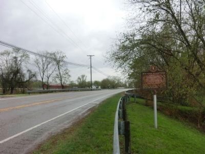
Location. 38° 21.882′ N, 82° 56.136′ W. Marker is near Grayson, Kentucky, in Carter County. Marker is on Carol Malone Road (Kentucky Route 1) one mile north of Interstate 64, on the right when traveling south. Touch for map. Marker is in this post office area: Grayson KY 41143, United States of America. Touch for directions.
Other nearby markers. At least 8 other markers are within 4 miles of this marker, measured as the crow flies. Civil War Reunion (approx. 2 miles away); Eastern Kentucky Railway (approx. 2.2 miles away); A Masterful Retreat (approx. 2.3 miles away); County Named, 1838 (approx. 2.4 miles away); We Honor William Jason Fields (approx. 2.4 miles away); Mount Savage Furnace (approx. 2˝ miles away); Grave of Lucy Virgin Downs (approx. 3.9 miles away); Hopewell Furnace / Iron Made in Kentucky (approx. 4 miles away). Touch for a list and map of all markers in Grayson.
Credits. This page was last revised on January 13, 2020. It was originally submitted on May 17, 2014, by Don Morfe of Baltimore, Maryland. This page has been viewed 777 times since then and 23 times this year. Photos: 1, 2, 3. submitted on May 17, 2014, by Don Morfe of Baltimore, Maryland. • Bill Pfingsten was the editor who published this page.


