Newfane in Niagara County, New York — The American Northeast (Mid-Atlantic)
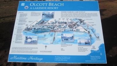
Olcott Beach
A Lakeside Resort
Where Families Came to Play
Once a prime recreation destination, Olcott Beach drew thousands annually. Trains brought summer vacationers from inland cities. Steamers ferried them between other lake ports. They stayed at grand hotels, played at amusement parks, and spent time swimming and enjoying the sandy beach.
The Rialto
This amusement park, built by the International Railway Company, features the "Figure 8", a large wooden roller coaster, a carousel and other family activities.
Rustic Theater
An outdoor theater presented shows of the day against a Lake Ontario backdrop.
Luna Park
Visitors found games, food, rides and souvenirs at this hotel side amusement area.
Olcott Pier
The "Chicora" steamed into Olcott Beach loaded with visitors from American and Canadian lake ports.
TIMELINE
1937: Olcott Beach Hotel demolished. During the Great Depression, people were no longer staying overnight, and the Hotel could not afford to repair damage caused by settlement of the foundation. Buses replaced the trolleys as the main form of transportation.
1930s: Top bands of the Great Band Era played at Olcott Beach, including Paul Whiteman, Guy Lombardo, Tommy Dorsey, Jimmy Dorsey, Louis Armstrong, Artie Sahw and Cab Calloway.
1927: The "Black Fire" destroyed a significant portion of Olcott bewtween Lockport Street and Eighteenmile Creek.
1907: Weeks Hotel wrecked by Carrie Nation.
1902: Olcott Beach Hotel opens. Visitors stayed at the palatial Olcott Beach Hotel with its 14,000 sq. ft. ballroom, dining room and large veranda overlooking the lake, and over 100 guest rooms.
1890s: Rustic Theater featured singers and jugglers. The Pioneer Association that built the Log Cabin hosted a pioneer picnic every third Wednesday in August. Theodore Rossevelt (then NY State Governor) spoke to a crowd of 20,000 here in 1899.
1889: First Carousel installed at Olcott Beach was called "The Electric Riding Gallery."
At one time there were 8 hotels in Olcott Beach. They were the Eagle Hotel, Cottage Hotel, Albright hotel, International Hotel, Rockwell Hotel, Harborview Hotel, The Bradley Hotel and the Olcott Beach Hotel (which was the largest).
The Castle Inn, which burned in 1912, was primarily a restaurant, but also had rooms for rent. The Bradley Hotel housed the workers who helped build the Olcott Beach Hotel. It is now known as the Olcott Inn, and is still located on Main Street.
Maritime Heritage. The Seaway Trail lakefront was a magnet for amusement parks in the early 20th century. Seaway Trail, Inc. Corner Ray &
West Main St., Sackets Harbor, NY 13685. 1-800-SEAWAY-T. This exhibit made possible by a grant from FHWA to Seaway Trail, Inc., and with the cooperation of the Niagara County Department of Planning, Development & Tourism.
Erected by Seaway Trail, Inc.
Topics and series. This historical marker is listed in these topic lists: Entertainment • Railroads & Streetcars. In addition, it is included in the Great Lakes Seaway Trail National Scenic Byway series list. A significant historical year for this entry is 1937.
Location. 43° 20.289′ N, 78° 42.76′ W. Marker is in Newfane, New York, in Niagara County. Marker is at the intersection of Franklin Street and East Main Street, on the right when traveling north on Franklin Street. Touch for map. Marker is in this post office area: Olcott NY 14126, United States of America. Touch for directions.
Other nearby markers. At least 8 other markers are within 2 miles of this marker, measured as the crow flies. Tom Kelly Rustic Theatre (within shouting distance of this marker); In Memory of Those Who for Their Splendid Spirit of Duty (within shouting distance of this marker); Kiddie Whistle Pig Ferris Wheel (within shouting distance of this marker); Olcott Amusement Park (about 300 feet away, measured in a direct line); One Country and One Flag (about 600 feet away); Lakeview (approx. 0.3 miles away); Site of Stone Marking the Northernmost Point of the Transit Surveyed by Joseph Ellicott (approx. 0.8 miles away); Home of James Van Horn (approx. 1.8 miles away). Touch for a list and map of all markers in Newfane.
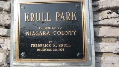
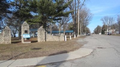
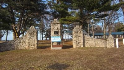
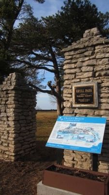
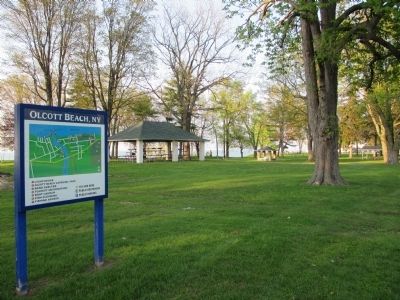
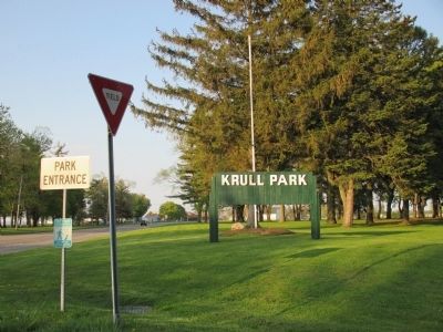
More about this marker. Marker is at the symbolic stone entrance to Krull Park.
Regarding Olcott Beach. Krull Park is a county park. It is segmented by a wide section of NY Route 18 (East Lake Road). The marker is on the road parallel and north of Route 18.
Also see . . .
1. Newfane, NY & Olcott Beach. Tourist information. (Submitted on May 20, 2014, by Anton Schwarzmueller of Wilson, New York.)
2. International Railway (IRC) - Wikipedia. Owner of the trolley line that brought city dwellers to Olcott. (Submitted on May 20, 2014, by Anton Schwarzmueller of Wilson, New York.)
3. Olcott Beach Carousel Park. The current amusements at Olcott. (Submitted on May 20, 2014, by Anton Schwarzmueller of Wilson, New York.)
4. Time Travelers of Western New York. Hosts of the largest annual classic car show in Western New York...at Olcott Beach. (Submitted on May 20, 2014, by Anton Schwarzmueller of Wilson, New York.)
Photographed By Anton Schwarzmueller, May 19, 2014
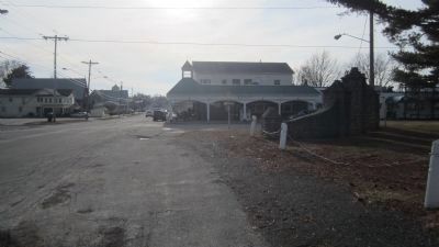
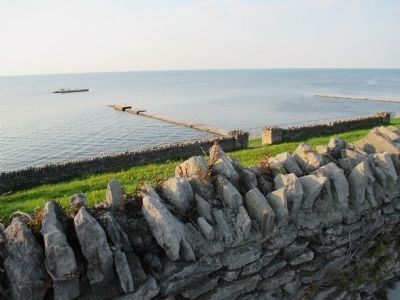
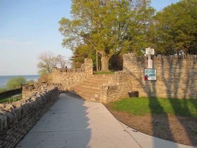
7. Krull Park from Shore Parking
Foot of Franklin Street where there are a few street side parking spaces, and more to the right. Steps to the beach are to the left. Steps ahead and right are to the picnic areas by the shore. There are no playgrounds in this area north of NY Route 18.
Credits. This page was last revised on June 16, 2016. It was originally submitted on May 20, 2014, by Anton Schwarzmueller of Wilson, New York. This page has been viewed 1,219 times since then and 78 times this year. Photos: 1, 2, 3, 4, 5, 6, 7, 8, 9, 10, 11, 12, 13. submitted on May 20, 2014, by Anton Schwarzmueller of Wilson, New York. • Bill Pfingsten was the editor who published this page.
